Terespol night lights from space
Night Light of Terespol (Lublin) from space (Poland) Src. Average luminocity for 10x10km area is 27.7447% and for 50x50km: 4.5261%.
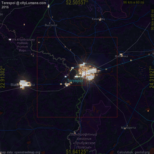
Analysis of Terespol night lights 2016
Square area 10x10 km:
 5.16%
5.16%90-99
4.63%80-89
1.72%70-79
3.84%60-69
3.44%50-59
4.89%40-49
2.78%30-39
1.46%20-29
8.99%10-19
20.5%0-9
42.59%Square area 50x50 km:
0.85%90-99
0.9%80-89
0.39%70-79
0.49%60-69
0.62%50-59
0.48%40-49
0.45%30-39
0.41%20-29
1.31%10-19
3.04%0-9
91.06%Clear (daylight) street map image can be seen on geolist.org.
Map coordinates:
52° 30' 20.1" North, 22° 54' 46.9" East
52° 4' 31.8" North, 23° 36' 58.1" East
51° 38' 28.5" North, 24° 19' 9.4" East
Some cities around Terespol sort by population:
• Brest, BY
5.5 km =3.4 mi,  63°
63°
• Biała Podlaska
34.5 km =21.4 mi,  262°
262°
• Kobryn, BY
52.8 km =32.8 mi,  73°
73°
• Międzyrzec Podlaski
57.9 km =36 mi, 260°
• Włodawa
58.6 km =36.4 mi,  184°
184°
• Zhabinka, BY
30.2 km =18.8 mi, 63°
• Malaryta, BY
44.6 km =27.7 mi,  135°
135°
• Kamyanyets, BY
38.4 km =23.9 mi,  20°
20°
756938 (p: 6,000)
Sources (retrieved 2019-11-25):
» Earth at Night: Flat Maps 2012, 2016