Biała Podlaska night lights from space
Night Light of Biała Podlaska (Lublin) from space (Poland) Src. Average luminocity for 10x10km area is 30.2487% and for 50x50km: 1.9872%.
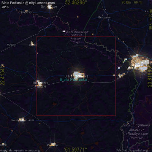
Analysis of Biała Podlaska night lights 2016
Square area 10x10 km:
 7.7%
7.7%90-99
8.84%80-89
1.26%70-79
2.4%60-69
2.53%50-59
2.27%40-49
0.76%30-39
0.51%20-29
3.91%10-19
38.38%0-9
31.44%Square area 50x50 km:
0.43%90-99
0.49%80-89
0.09%70-79
0.19%60-69
0.17%50-59
0.14%40-49
0.06%30-39
0.1%20-29
0.22%10-19
2.01%0-9
96.09%Clear (daylight) street map image can be seen on geolist.org.
Map coordinates:
52° 27' 46.3" North, 22° 24' 48.2" East
52° 1' 56.6" North, 23° 6' 59.5" East
51° 35' 51.8" North, 23° 49' 10.7" East
Some cities around Biała Podlaska sort by population:
• Brest, BY
39.7 km =24.7 mi,  79°
79°
• Łuków
51.8 km =32.2 mi,  257°
257°
• Międzyrzec Podlaski
23.4 km =14.5 mi, 257°
• Radzyń Podlaski
44.1 km =27.4 mi,  231°
231°
• Siemiatycze
47.2 km =29.3 mi,  338°
338°
• Parczew
46.1 km =28.6 mi,  198°
198°
• Łosice
33.7 km =20.9 mi,  306°
306°
• Terespol
34.5 km =21.4 mi, 82°
776175 (p: 57,541)
Sources (retrieved 2019-11-25):
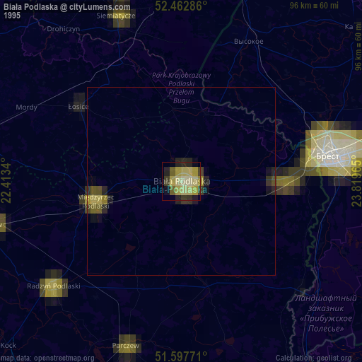
» NASA, Earths city lights 1995
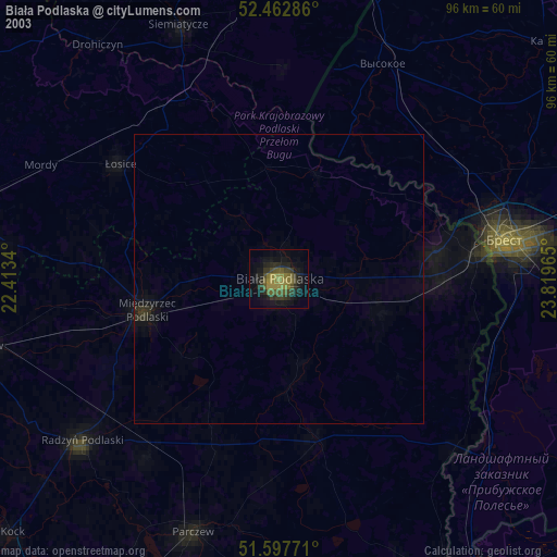
» NASA city lights 2003
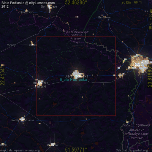
» Earth at Night: Flat Maps 2012, 2016