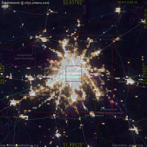
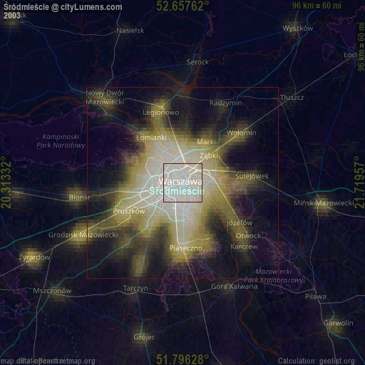
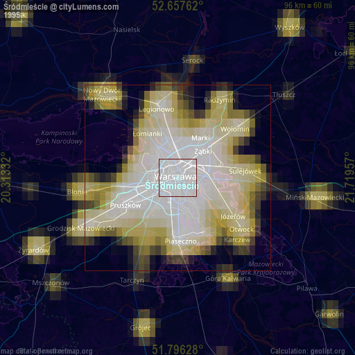
Śródmieście night lights from space
Night Light of Śródmieście (Mazovia) from space (Poland) Src. Average luminocity for 10x10km area is 99.6349% and for 50x50km: 43.5415%.

Analysis of Śródmieście night lights 2016
Square area 10x10 km:
 92.59%
90-99
5.95%80-89
1.19%70-79
0.26%60-69
0%50-59
0%40-49
0%30-39
0%20-29
0%10-19
0%0-9
0%Square area 50x50 km:
13.82%90-99
9.13%80-89
3.7%70-79
3.99%60-69
4.59%50-59
4.67%40-49
4.82%30-39
5.31%20-29
9.56%10-19
14.87%0-9
25.54%Clear (daylight) street map image can be seen on geolist.org.
Map coordinates:
52° 39' 27.4" North, 20° 18' 48" East
52° 13' 44.5" North, 21° 0' 59.2" East
51° 47' 46.6" North, 21° 43' 10.5" East
Some cities around Śródmieście sort by population:
• Warsaw
0.3 km =0.2 mi,  284°
284°
• Mokotów
4.2 km =2.6 mi,  162°
162°
• Praga Południe
5 km =3.1 mi,  70°
70°
• Wola
2.3 km =1.4 mi,  303°
303°
• Targówek
7.3 km =4.5 mi,  17°
17°
• Praga Północ
3.1 km =1.9 mi, 23°
• Ochota
2.3 km =1.4 mi,  247°
247°
• Żoliborz
4.9 km =3 mi,  335°
335°
758470 (p: 134,306)
Sources (retrieved 2019-11-25):
» NASA, Earths city lights 1995
» NASA city lights 2003
» Earth at Night: Flat Maps 2012, 2016