Siedlce night lights from space
Night Light of Siedlce (Mazovia) from space (Poland) Src. Average luminocity for 10x10km area is 33.9854% and for 50x50km: 1.9242%.
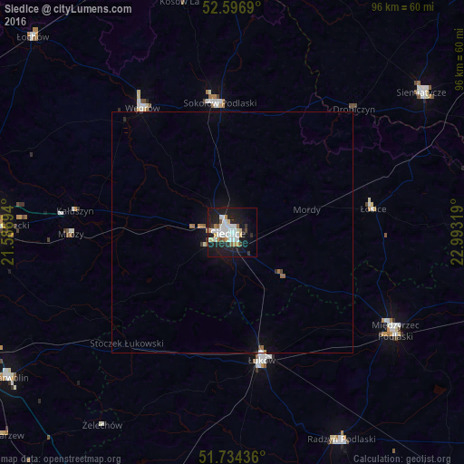

Analysis of Siedlce night lights 2016
Square area 10x10 km:
 9.66%
9.66%90-99
7.8%80-89
2.91%70-79
3.31%60-69
1.46%50-59
2.12%40-49
1.85%30-39
2.12%20-29
8.73%10-19
36.38%0-9
23.68%Square area 50x50 km:
0.4%90-99
0.33%80-89
0.13%70-79
0.16%60-69
0.2%50-59
0.13%40-49
0.12%30-39
0.12%20-29
0.4%10-19
1.98%0-9
96.03%Clear (daylight) street map image can be seen on geolist.org.
Map coordinates:
52° 35' 48.8" North, 21° 35' 13" East
52° 10' 3.8" North, 22° 17' 24.2" East
51° 44' 3.7" North, 22° 59' 35.5" East
Some cities around Siedlce sort by population:
• Mińsk Mazowiecki
48.9 km =30.4 mi,  271°
271°
• Łuków
27.2 km =16.9 mi,  167°
167°
• Sokołów Podlaski
26.7 km =16.6 mi,  354°
354°
• Międzyrzec Podlaski
39.2 km =24.4 mi,  120°
120°
• Radzyń Podlaski
48.2 km =30 mi,  152°
152°
• Siemiatycze
48.4 km =30.1 mi,  53°
53°
• Węgrów
31.8 km =19.8 mi,  324°
324°
• Łosice
29.6 km =18.4 mi,  80°
80°
759412 (p: 77,185)
Sources (retrieved 2019-11-25):
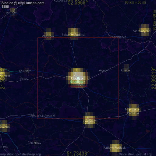
» NASA, Earths city lights 1995
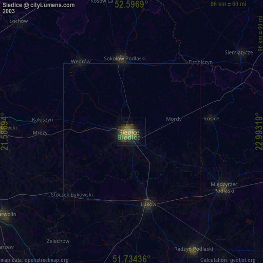
» NASA city lights 2003
» Earth at Night: Flat Maps 2012, 2016