Racibórz night lights from space
Night Light of Racibórz (Silesia) from space (Poland) Src. Average luminocity for 10x10km area is 19.9202% and for 50x50km: 9.9304%.
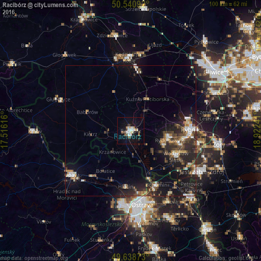
Analysis of Racibórz night lights 2016
Square area 10x10 km:
 4.62%
4.62%90-99
4.2%80-89
0.7%70-79
2.38%60-69
1.96%50-59
0.42%40-49
3.08%30-39
1.12%20-29
1.12%10-19
21.57%0-9
58.82%Square area 50x50 km:
1.15%90-99
1.39%80-89
0.63%70-79
0.94%60-69
1.28%50-59
1.28%40-49
2.1%30-39
1.81%20-29
4.16%10-19
8.73%0-9
76.53%Clear (daylight) street map image can be seen on geolist.org.
Map coordinates:
50° 32' 27.3" North, 17° 30' 58.2" East
50° 5' 31" North, 18° 13' 9.4" East
49° 38' 19.4" North, 18° 55' 20.7" East
Some cities around Racibórz sort by population:
• Wodzisław Śląski
20.5 km =12.7 mi,  118°
118°
• Starý Bohumín, CZ
21.2 km =13.2 mi,  156°
156°
• Rydułtowy
14.6 km =9.1 mi,  104°
104°
• Radlin
18.9 km =11.7 mi, 104°
• Pszów
13.8 km =8.6 mi,  114°
114°
• Niedobczyce
19.9 km =12.4 mi, 98°
• Kietrz
15.4 km =9.6 mi,  265°
265°
• Kuźnia Raciborska
13.7 km =8.5 mi,  28°
28°
3087584 (p: 58,464)
Sources (retrieved 2019-11-25):
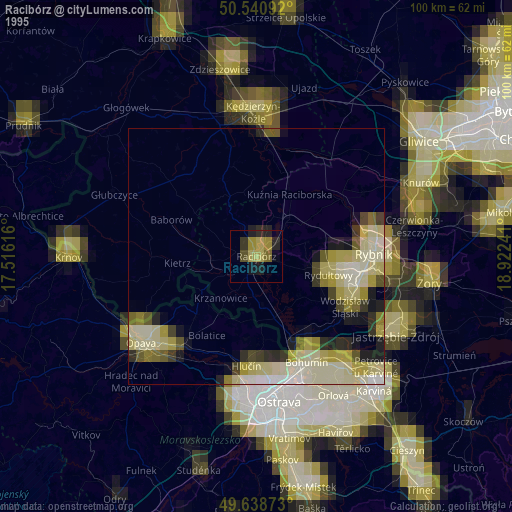
» NASA, Earths city lights 1995
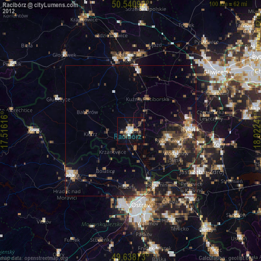
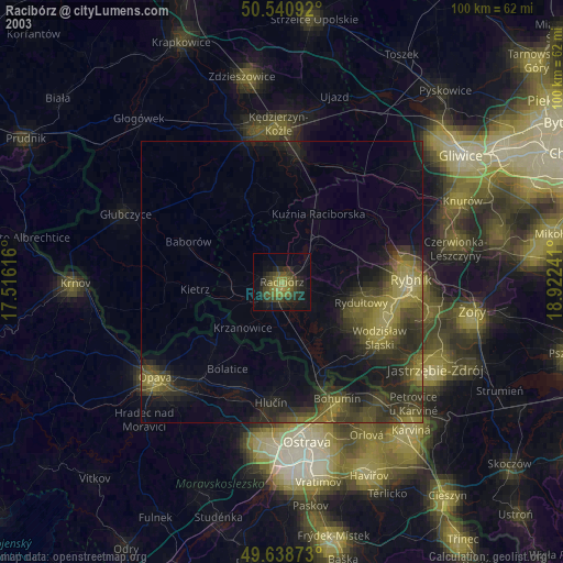
» NASA city lights 2003
» Earth at Night: Flat Maps 2012, 2016