Przemków night lights from space
Night Light of Przemków (Lower Silesia) from space (Poland) Src. Average luminocity for 10x10km area is 1.1497% and for 50x50km: 3.2684%.
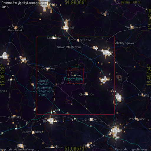
Analysis of Przemków night lights 2016
Square area 10x10 km:
 0%
0%90-99
0%80-89
0%70-79
0.53%60-69
0.53%50-59
0%40-49
0%30-39
1.07%20-29
0%10-19
0%0-9
97.86%Square area 50x50 km:
0.61%90-99
0.64%80-89
0.19%70-79
0.18%60-69
0.3%50-59
0.33%40-49
0.38%30-39
0.39%20-29
0.32%10-19
2.75%0-9
93.91%Clear (daylight) street map image can be seen on geolist.org.
Map coordinates:
51° 57' 38.4" North, 15° 5' 28.6" East
51° 31' 31.1" North, 15° 47' 39.9" East
51° 5' 8.6" North, 16° 29' 51.1" East
Some cities around Przemków sort by population:
• Lubin
31.4 km =19.5 mi,  116°
116°
• Głogów
25.3 km =15.7 mi,  52°
52°
• Nowa Sól
31.4 km =19.5 mi,  350°
350°
• Polkowice
19.4 km =12.1 mi,  97°
97°
• Chojnów
29.7 km =18.5 mi,  160°
160°
• Szprotawa
18.4 km =11.4 mi,  284°
284°
• Kożuchów
28.1 km =17.5 mi,  330°
330°
• Chocianów
14 km =8.7 mi,  147°
147°
3087954 (p: 6,487)
Sources (retrieved 2019-11-25):
» Earth at Night: Flat Maps 2012, 2016