Prabuty night lights from space
Night Light of Prabuty (Pomerania) from space (Poland) Src. Average luminocity for 10x10km area is 2.9306% and for 50x50km: 2.096%.
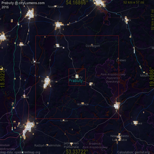
Analysis of Prabuty night lights 2016
Square area 10x10 km:
100  0.51%
0.51%
90-99 0.51%
80-89 0.51%
70-79 0%
60-69 1.01%
50-59 0.51%
40-49 0%
30-39 0.38%
20-29 0.13%
10-19 0%
0-9 96.46%
0.51%90-99
0.51%80-89
0.51%70-79
0%60-69
1.01%50-59
0.51%40-49
0%30-39
0.38%20-29
0.13%10-19
0%0-9
96.46%Square area 50x50 km:
100 0.5%
90-99 0.48%
80-89 0.15%
70-79 0.13%
60-69 0.11%
50-59 0.17%
40-49 0.2%
30-39 0.15%
20-29 0.12%
10-19 1.72%
0-9 96.25%
0.5%90-99
0.48%80-89
0.15%70-79
0.13%60-69
0.11%50-59
0.17%40-49
0.2%30-39
0.15%20-29
0.12%10-19
1.72%0-9
96.25%Clear (daylight) street map image can be seen on geolist.org.
Map coordinates:
54° 10' 7.2" North, 18° 30' 8.5" East
53° 45' 18" North, 19° 12' 19.7" East
53° 20' 14" North, 19° 54' 31" East
Some cities around Prabuty sort by population:
• Malbork
33.4 km =20.8 mi,  339°
339°
• Kwidzyn
18.3 km =11.4 mi,  259°
259°
• Iława
29.7 km =18.5 mi,  126°
126°
• Sztum
21.7 km =13.5 mi,  328°
328°
• Gniew
26.7 km =16.6 mi,  289°
289°
• Nowe
33.6 km =20.9 mi,  249°
249°
• Susz
9.6 km =6 mi,  115°
115°
• Dzierzgoń
20.8 km =12.9 mi,  26°
26°
3088161 (p: 8,488)
Sources (retrieved 2019-11-25):
» Earth at Night: Flat Maps 2012, 2016