Malbork night lights from space
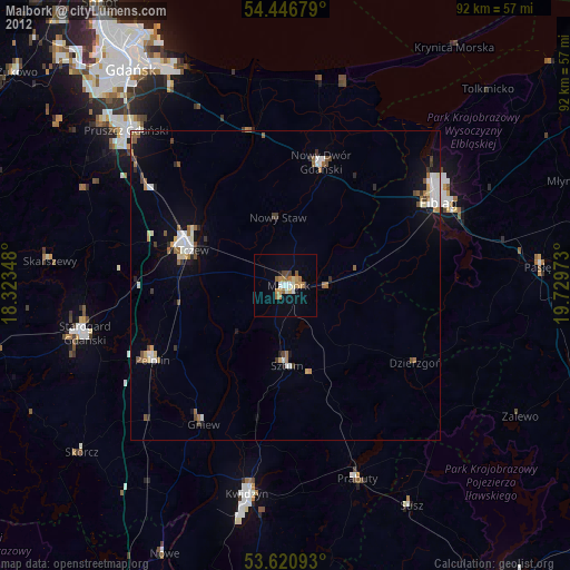
Night Light of Malbork (Pomerania) from space (Poland) Src. Average luminocity for 10x10km area is 16.577% and for 50x50km: 4.3124%.
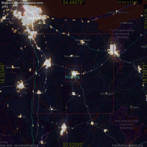
Analysis of Malbork night lights 2016
Square area 10x10 km:
 2.4%
2.4%90-99
3.66%80-89
1.77%70-79
2.02%60-69
1.64%50-59
1.14%40-49
1.89%30-39
1.14%20-29
0.51%10-19
14.14%0-9
69.7%Square area 50x50 km:
0.83%90-99
0.89%80-89
0.29%70-79
0.41%60-69
0.4%50-59
0.35%40-49
0.41%30-39
0.33%20-29
0.69%10-19
3.74%0-9
91.67%Clear (daylight) street map image can be seen on geolist.org.
Map coordinates:
54° 26' 48.4" North, 18° 19' 24.5" East
54° 2' 9.3" North, 19° 1' 35.8" East
53° 37' 15.3" North, 19° 43' 47" East
Some cities around Malbork sort by population:
• Elbląg
28.1 km =17.5 mi,  62°
62°
• Tczew
17.4 km =10.8 mi,  291°
291°
• Nowy Dwór Gdański
20.6 km =12.8 mi,  16°
16°
• Sztum
12.8 km =8 mi,  178°
178°
• Prabuty
33.4 km =20.8 mi,  159°
159°
• Pelplin
24.6 km =15.3 mi,  240°
240°
• Gniew
25.9 km =16.1 mi,  210°
210°
• Dzierzgoń
24.5 km =15.2 mi,  121°
121°
3092472 (p: 38,655)
Sources (retrieved 2019-11-25):
» Earth at Night: Flat Maps 2012, 2016