Sztum night lights from space
Night Light of Sztum (Pomerania) from space (Poland) Src. Average luminocity for 10x10km area is 5.041% and for 50x50km: 3.9432%.
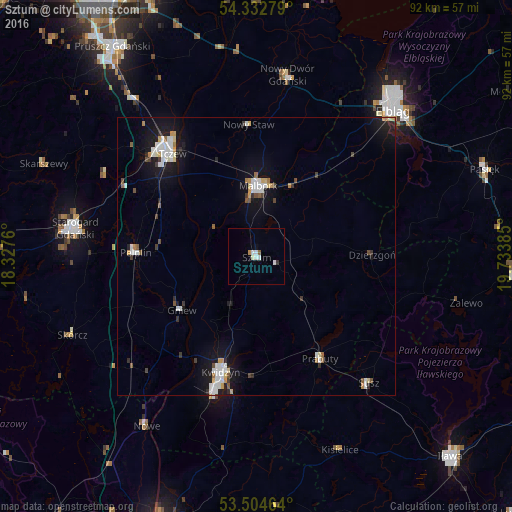
Analysis of Sztum night lights 2016
Square area 10x10 km:
 1.72%
1.72%90-99
1.19%80-89
0.26%70-79
0.4%60-69
0.13%50-59
0.53%40-49
0%30-39
0.53%20-29
0%10-19
0.13%0-9
95.11%Square area 50x50 km:
0.82%90-99
0.78%80-89
0.32%70-79
0.34%60-69
0.27%50-59
0.28%40-49
0.36%30-39
0.39%20-29
0.46%10-19
3.57%0-9
92.39%Clear (daylight) street map image can be seen on geolist.org.
Map coordinates:
54° 19' 58" North, 18° 19' 39.4" East
53° 55' 14.8" North, 19° 1' 50.6" East
53° 30' 16.7" North, 19° 44' 1.9" East
Some cities around Sztum sort by population:
• Tczew
25.2 km =15.7 mi,  319°
319°
• Malbork
12.8 km =8 mi,  358°
358°
• Kwidzyn
22.7 km =14.1 mi,  196°
196°
• Prabuty
21.7 km =13.5 mi,  148°
148°
• Pelplin
21.8 km =13.5 mi,  272°
272°
• Gniew
16.6 km =10.3 mi,  235°
235°
• Susz
30.2 km =18.8 mi,  138°
138°
• Dzierzgoń
20.7 km =12.9 mi,  89°
89°
3083616 (p: 9,766)
Sources (retrieved 2019-11-25):
» Earth at Night: Flat Maps 2012, 2016