Piła night lights from space
Night Light of Piła (Greater Poland) from space (Poland) Src. Average luminocity for 10x10km area is 30.5808% and for 50x50km: 2.9576%.

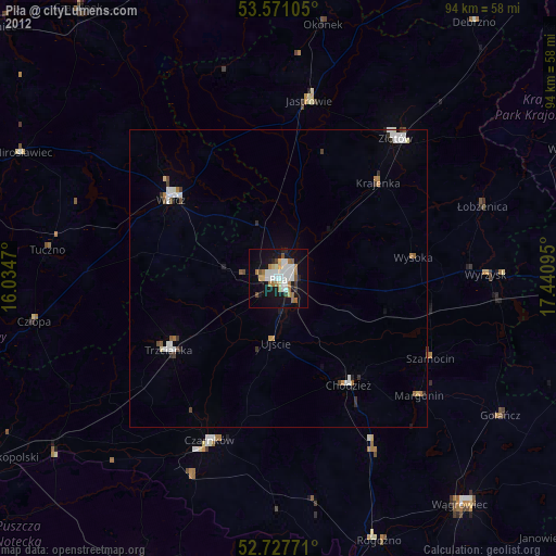
Analysis of Piła night lights 2016
Square area 10x10 km:
 8.46%
8.46%90-99
8.08%80-89
1.64%70-79
1.01%60-69
2.02%50-59
3.79%40-49
0.88%30-39
1.89%20-29
4.29%10-19
36.87%0-9
31.06%Square area 50x50 km:
0.65%90-99
0.58%80-89
0.26%70-79
0.16%60-69
0.21%50-59
0.33%40-49
0.31%30-39
0.27%20-29
0.31%10-19
1.87%0-9
95.05%Clear (daylight) street map image can be seen on geolist.org.
Map coordinates:
53° 34' 15.8" North, 16° 2' 4.9" East
53° 9' 5.2" North, 16° 44' 16.2" East
52° 43' 39.8" North, 17° 26' 27.4" East
Some cities around Piła sort by population:
• Wałcz
22.6 km =14 mi,  308°
308°
• Chodzież
21.2 km =13.2 mi,  145°
145°
• Złotów
31 km =19.3 mi,  40°
40°
• Trzcianka
22.5 km =14 mi,  236°
236°
• Czarnków
30.1 km =18.7 mi,  202°
202°
• Jastrowie
30.4 km =18.9 mi,  10°
10°
• Wieleń
47.4 km =29.5 mi,  232°
232°
• Wyrzysk
35.4 km =22 mi,  89°
89°
3089033 (p: 75,532)
Sources (retrieved 2019-11-25):
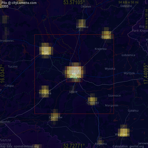
» NASA, Earths city lights 1995
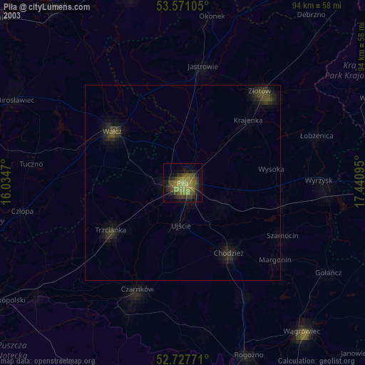
» NASA city lights 2003
» Earth at Night: Flat Maps 2012, 2016