Pasłęk night lights from space
Night Light of Pasłęk (Warmia-Masuria) from space (Poland) Src. Average luminocity for 10x10km area is 6.4596% and for 50x50km: 2.4246%.
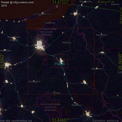
Analysis of Pasłęk night lights 2016
Square area 10x10 km:
 1.26%
1.26%90-99
1.26%80-89
0.51%70-79
1.01%60-69
0.51%50-59
0.51%40-49
1.26%30-39
0.25%20-29
0.51%10-19
0%0-9
92.93%Square area 50x50 km:
0.55%90-99
0.55%80-89
0.13%70-79
0.19%60-69
0.21%50-59
0.17%40-49
0.25%30-39
0.22%20-29
0.58%10-19
1.85%0-9
95.3%Clear (daylight) street map image can be seen on geolist.org.
Map coordinates:
54° 28' 20" North, 18° 57' 22.3" East
54° 3' 41.8" North, 19° 39' 33.6" East
53° 38' 48.7" North, 20° 21' 44.8" East
Some cities around Pasłęk sort by population:
• Elbląg
19.2 km =11.9 mi,  301°
301°
• Malbork
41.4 km =25.7 mi,  266°
266°
• Braniewo
36.9 km =22.9 mi,  16°
16°
• Morąg
23.7 km =14.7 mi,  132°
132°
• Nowy Dwór Gdański
39.1 km =24.3 mi, 295°
• Orneta
31.5 km =19.6 mi,  79°
79°
• Susz
43.7 km =27.2 mi,  208°
208°
• Dzierzgoń
25.6 km =15.9 mi,  232°
232°
3089392 (p: 12,267)
Sources (retrieved 2019-11-25):
» Earth at Night: Flat Maps 2012, 2016