Nowy Dwór Gdański night lights from space
Night Light of Nowy Dwór Gdański (Pomerania) from space (Poland) Src. Average luminocity for 10x10km area is 4.2897% and for 50x50km: 4.9424%.
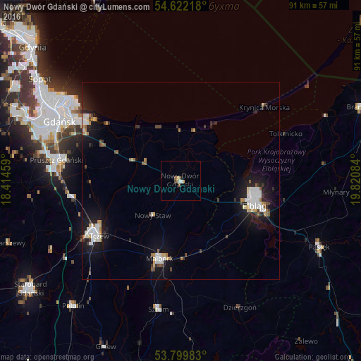
Analysis of Nowy Dwór Gdański night lights 2016
Square area 10x10 km:
 0.66%
0.66%90-99
0.4%80-89
0.53%70-79
0.93%60-69
0.66%50-59
1.06%40-49
0.53%30-39
0%20-29
0.4%10-19
0.13%0-9
94.71%Square area 50x50 km:
0.94%90-99
0.99%80-89
0.38%70-79
0.45%60-69
0.5%50-59
0.39%40-49
0.42%30-39
0.47%20-29
1.06%10-19
4.68%0-9
89.71%Clear (daylight) street map image can be seen on geolist.org.
Map coordinates:
54° 37' 19.8" North, 18° 24' 52.5" East
54° 12' 47" North, 19° 7' 3.8" East
53° 47' 59.4" North, 19° 49' 15" East
Some cities around Nowy Dwór Gdański sort by population:
• Gdańsk
34.3 km =21.3 mi,  296°
296°
• Elbląg
20.1 km =12.5 mi,  109°
109°
• Tczew
25.9 km =16.1 mi,  238°
238°
• Malbork
20.6 km =12.8 mi,  196°
196°
• Pruszcz Gdański
31.8 km =19.8 mi,  279°
279°
• Pasłęk
39.1 km =24.3 mi,  115°
115°
• Sztum
33 km =20.5 mi,  189°
189°
• Dzierzgoń
35.7 km =22.2 mi,  155°
155°
3090502 (p: 9,822)
Sources (retrieved 2019-11-25):
» Earth at Night: Flat Maps 2012, 2016