Myszków night lights from space
Night Light of Myszków (Silesia) from space (Poland) Src. Average luminocity for 10x10km area is 11.2326% and for 50x50km: 8.2956%.
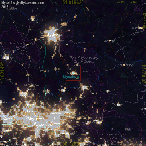
Analysis of Myszków night lights 2016
Square area 10x10 km:
 0.53%
0.53%90-99
1.6%80-89
1.07%70-79
1.07%60-69
1.6%50-59
2.41%40-49
3.48%30-39
1.07%20-29
0%10-19
1.07%0-9
86.1%Square area 50x50 km:
0.77%90-99
1.07%80-89
0.63%70-79
0.57%60-69
1.07%50-59
1.41%40-49
2.18%30-39
2.14%20-29
2.65%10-19
5.46%0-9
82.04%Clear (daylight) street map image can be seen on geolist.org.
Map coordinates:
51° 1' 10.6" North, 18° 37' 17.4" East
50° 34' 30.7" North, 19° 19' 28.6" East
50° 7' 35.6" North, 20° 1' 39.9" East
Some cities around Myszków sort by population:
• Częstochowa
28.4 km =17.6 mi,  330°
330°
• Dąbrowa Górnicza
28.1 km =17.5 mi,  197°
197°
• Zawiercie
11.7 km =7.3 mi,  146°
146°
• Poręba
9.7 km =6 mi,  173°
173°
• Kalety
30.5 km =19 mi,  267°
267°
• Miasteczko Śląskie
28.4 km =17.6 mi,  253°
253°
• Łazy
17.1 km =10.6 mi,  163°
163°
• Siewierz
13.8 km =8.6 mi,  208°
208°
3091217 (p: 33,273)
Sources (retrieved 2019-11-25):
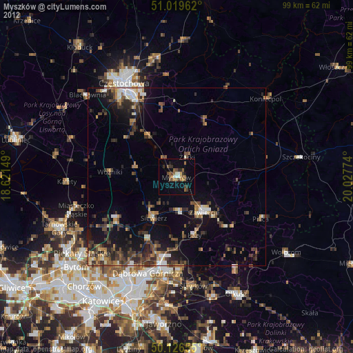
» Earth at Night: Flat Maps 2012, 2016