Mysłakowice night lights from space
Night Light of Mysłakowice (Lower Silesia) from space (Poland) Src. Average luminocity for 10x10km area is 8.0112% and for 50x50km: 2.9209%.
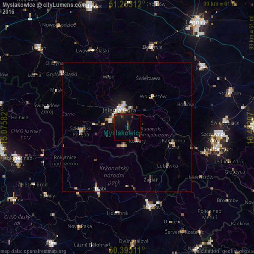
Analysis of Mysłakowice night lights 2016
Square area 10x10 km:
 0%
0%90-99
0%80-89
0.84%70-79
0.7%60-69
0.56%50-59
0%40-49
2.24%30-39
1.54%20-29
1.68%10-19
16.95%0-9
75.49%Square area 50x50 km:
0.37%90-99
0.47%80-89
0.37%70-79
0.22%60-69
0.47%50-59
0.3%40-49
0.39%30-39
0.37%20-29
0.34%10-19
2.08%0-9
94.62%Clear (daylight) street map image can be seen on geolist.org.
Map coordinates:
51° 16' 59.2" North, 15° 4' 33" East
50° 50' 28.4" North, 15° 46' 44.2" East
50° 23' 42.4" North, 16° 28' 55.5" East
Some cities around Mysłakowice sort by population:
• Jelenia Góra
7.4 km =4.6 mi,  331°
331°
• Kamienna Góra
18.8 km =11.7 mi,  110°
110°
• Cieplice Śląskie Zdrój
7.2 km =4.5 mi,  291°
291°
• Kowary
6.7 km =4.2 mi,  143°
143°
• Szklarska Poręba
18.1 km =11.2 mi,  264°
264°
• Piechowice
12.7 km =7.9 mi,  274°
274°
• Lubawka
21.8 km =13.5 mi,  134°
134°
• Bolków
24.3 km =15.1 mi,  68°
68°
3091263 (p: 5,100)
Sources (retrieved 2019-11-25):
» Earth at Night: Flat Maps 2012, 2016