Legnica night lights from space
Night Light of Legnica (Lower Silesia) from space (Poland) Src. Average luminocity for 10x10km area is 38.3557% and for 50x50km: 3.9714%.
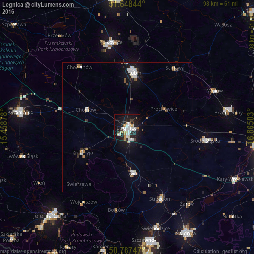
Analysis of Legnica night lights 2016
Square area 10x10 km:
 11.76%
90-99
9.94%80-89
1.82%70-79
3.08%60-69
3.36%50-59
0.56%40-49
2.24%30-39
2.66%20-29
12.89%10-19
32.77%0-9
18.91%Square area 50x50 km:
0.87%90-99
0.88%80-89
0.26%70-79
0.23%60-69
0.36%50-59
0.27%40-49
0.4%30-39
0.42%20-29
0.77%10-19
3.17%0-9
92.37%Clear (daylight) street map image can be seen on geolist.org.
Map coordinates:
51° 38' 54.4" North, 15° 27' 31.6" East
51° 12' 36.2" North, 16° 9' 42.8" East
50° 46' 2.9" North, 16° 51' 54.1" East
Some cities around Legnica sort by population:
• Lubin
21.4 km =13.3 mi,  7°
7°
• Jawor
17.8 km =11.1 mi,  172°
172°
• Strzegom
30.5 km =19 mi,  154°
154°
• Złotoryja
19.3 km =12 mi,  241°
241°
• Chojnów
17.2 km =10.7 mi,  294°
294°
• Środa Śląska
30.6 km =19 mi,  99°
99°
• Chocianów
29.4 km =18.3 mi,  322°
322°
• Ścinawa
29.3 km =18.2 mi,  38°
38°
3093692 (p: 106,033)
Sources (retrieved 2019-11-25):
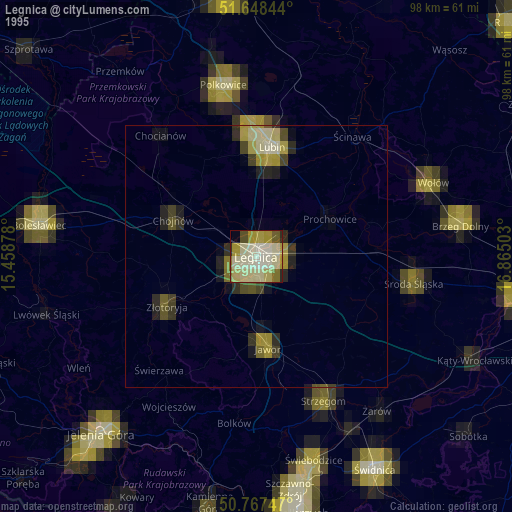
» NASA, Earths city lights 1995
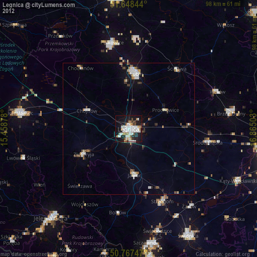
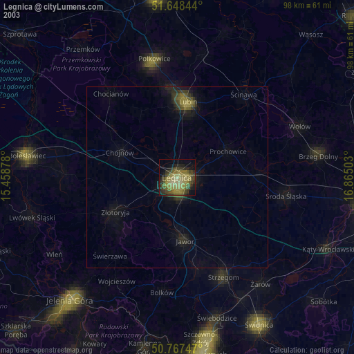
» NASA city lights 2003
» Earth at Night: Flat Maps 2012, 2016