Jawor night lights from space
Night Light of Jawor (Lower Silesia) from space (Poland) Src. Average luminocity for 10x10km area is 8.012% and for 50x50km: 4.92%.
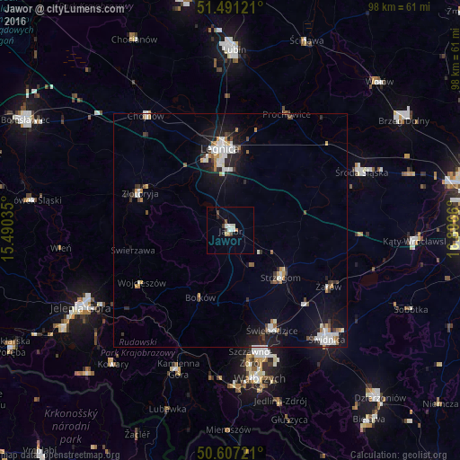
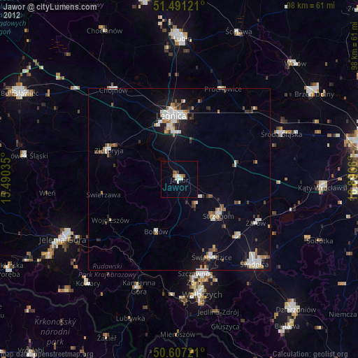
Analysis of Jawor night lights 2016
Square area 10x10 km:
 1.6%
1.6%90-99
2.14%80-89
0.53%70-79
0.13%60-69
0.94%50-59
0.53%40-49
0.94%30-39
1.2%20-29
0.53%10-19
0%0-9
91.44%Square area 50x50 km:
0.95%90-99
1.1%80-89
0.18%70-79
0.5%60-69
0.41%50-59
0.32%40-49
0.54%30-39
0.54%20-29
1.16%10-19
3.82%0-9
90.48%Clear (daylight) street map image can be seen on geolist.org.
Map coordinates:
51° 29' 28.4" North, 15° 29' 25.3" East
51° 3' 4.8" North, 16° 11' 36.5" East
50° 36' 26" North, 16° 53' 47.8" East
Some cities around Jawor sort by population:
• Legnica
17.8 km =11.1 mi,  352°
352°
• Świebodzice
23.1 km =14.4 mi,  157°
157°
• Strzegom
14.7 km =9.1 mi,  131°
131°
• Złotoryja
20.9 km =13 mi,  293°
293°
• Chojnów
30.5 km =19 mi,  324°
324°
• Żarów
24.4 km =15.2 mi,  120°
120°
• Szczawno-Zdrój
27.9 km =17.3 mi,  170°
170°
• Bolków
15.8 km =9.8 mi,  204°
204°
3097367 (p: 23,865)
Sources (retrieved 2019-11-25):
» Earth at Night: Flat Maps 2012, 2016