Koźmin Wielkopolski night lights from space
Night Light of Koźmin Wielkopolski (Greater Poland) from space (Poland) Src. Average luminocity for 10x10km area is 3.7269% and for 50x50km: 3.027%.
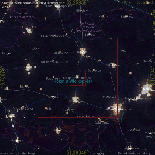
Analysis of Koźmin Wielkopolski night lights 2016
Square area 10x10 km:
 0%
0%90-99
0.84%80-89
0.84%70-79
0.56%60-69
0.56%50-59
0.42%40-49
0.14%30-39
1.12%20-29
0.56%10-19
0.56%0-9
94.4%Square area 50x50 km:
0.36%90-99
0.51%80-89
0.28%70-79
0.46%60-69
0.34%50-59
0.44%40-49
0.37%30-39
0.43%20-29
0.42%10-19
1.65%0-9
94.75%Clear (daylight) street map image can be seen on geolist.org.
Map coordinates:
52° 15' 34.5" North, 16° 45' 2.8" East
51° 49' 37.6" North, 17° 27' 14.1" East
51° 23' 25.7" North, 18° 9' 25.3" East
Some cities around Koźmin Wielkopolski sort by population:
• Kalisz
44.4 km =27.6 mi,  99°
99°
• Ostrów Wielkopolski
30.9 km =19.2 mi,  128°
128°
• Śrem
41.8 km =26 mi,  314°
314°
• Krotoszyn
14.3 km =8.9 mi,  184°
184°
• Jarocin
16.5 km =10.3 mi,  11°
11°
• Gostyń
30.9 km =19.2 mi,  281°
281°
• Pleszew
24 km =14.9 mi,  71°
71°
• Milicz
35.6 km =22.1 mi,  200°
200°
3094852 (p: 6,678)
Sources (retrieved 2019-11-25):
» Earth at Night: Flat Maps 2012, 2016