Jedlicze night lights from space
Night Light of Jedlicze (Subcarpathia) from space (Poland) Src. Average luminocity for 10x10km area is 7.0588% and for 50x50km: 2.5116%.
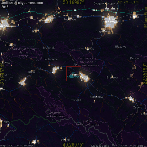
Analysis of Jedlicze night lights 2016
Square area 10x10 km:
 0.94%
0.94%90-99
0.67%80-89
0.4%70-79
0.13%60-69
0.27%50-59
1.34%40-49
2.67%30-39
1.07%20-29
0.4%10-19
8.69%0-9
83.42%Square area 50x50 km:
0.46%90-99
0.5%80-89
0.23%70-79
0.18%60-69
0.12%50-59
0.25%40-49
0.41%30-39
0.2%20-29
0.28%10-19
2.38%0-9
94.99%Clear (daylight) street map image can be seen on geolist.org.
Map coordinates:
50° 10' 11.9" North, 20° 56' 44.7" East
49° 43' 3" North, 21° 38' 55.9" East
49° 15' 38.7" North, 22° 21' 7.2" East
Some cities around Jedlicze sort by population:
• Krosno
9.3 km =5.8 mi,  110°
110°
• Jasło
13 km =8.1 mi,  283°
283°
• Gorlice
35.8 km =22.2 mi,  258°
258°
• Ropczyce
37.3 km =23.2 mi,  355°
355°
• Strzyżów
20 km =12.4 mi,  31°
31°
• Brzozów
26.8 km =16.7 mi,  95°
95°
• Korczyna
11.5 km =7.1 mi,  91°
91°
• Boguchwała
36.5 km =22.7 mi,  35°
35°
770169 (p: 5,629)
Sources (retrieved 2019-11-25):
» Earth at Night: Flat Maps 2012, 2016