Cieszyn night lights from space
Night Light of Cieszyn (Silesia) from space (Poland) Src. Average luminocity for 10x10km area is 26.3917% and for 50x50km: 13.7921%.
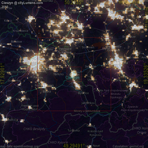
Analysis of Cieszyn night lights 2016
Square area 10x10 km:
 4.28%
4.28%90-99
4.28%80-89
4.41%70-79
2.94%60-69
0.67%50-59
1.07%40-49
3.48%30-39
2.41%20-29
8.56%10-19
37.17%0-9
30.75%Square area 50x50 km:
1.68%90-99
2.09%80-89
1.21%70-79
1.45%60-69
1.65%50-59
1.7%40-49
2.28%30-39
2.17%20-29
4.6%10-19
14.65%0-9
66.52%Clear (daylight) street map image can be seen on geolist.org.
Map coordinates:
50° 12' 12.6" North, 17° 55' 44.4" East
49° 45' 4.8" North, 18° 37' 55.7" East
49° 17' 41.7" North, 19° 20' 6.9" East
Some cities around Cieszyn sort by population:
• Havířov, CZ
14.4 km =8.9 mi,  282°
282°
• Karviná, CZ
13.1 km =8.1 mi,  330°
330°
• Třinec, CZ
8.7 km =5.4 mi,  161°
161°
• Český Těšín, CZ
0.7 km =0.4 mi,  216°
216°
• Ustroń
12.6 km =7.8 mi,  105°
105°
• Skoczów
12.5 km =7.8 mi,  63°
63°
• Bystřice, CZ
14.3 km =8.9 mi,  153°
153°
• Zebrzydowice
14.2 km =8.8 mi,  353°
353°
3101321 (p: 35,586)
Sources (retrieved 2019-11-25):
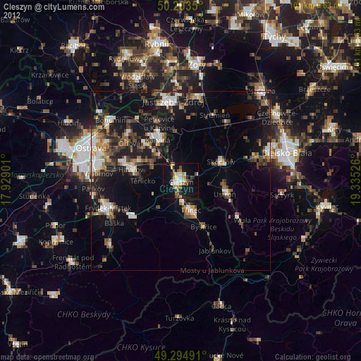
» Earth at Night: Flat Maps 2012, 2016