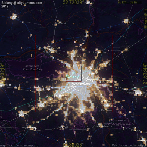
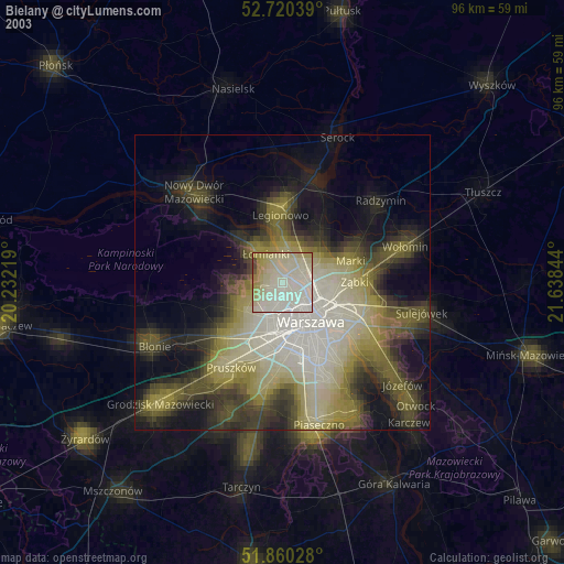
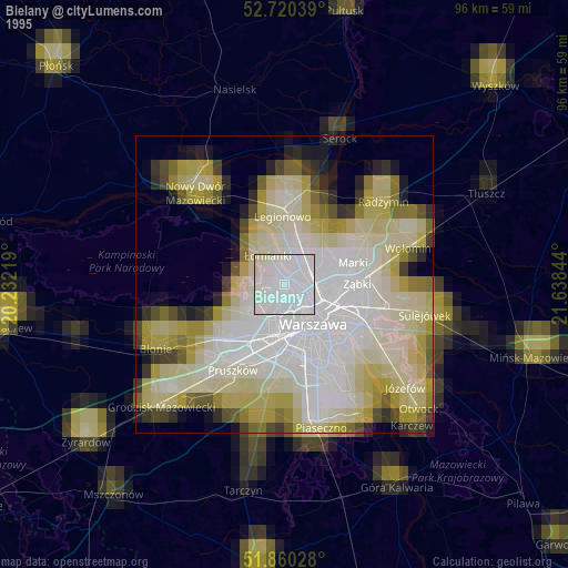
Bielany night lights from space
Night Light of Bielany (Mazovia) from space (Poland) Src. Average luminocity for 10x10km area is 91.029% and for 50x50km: 43.3568%.
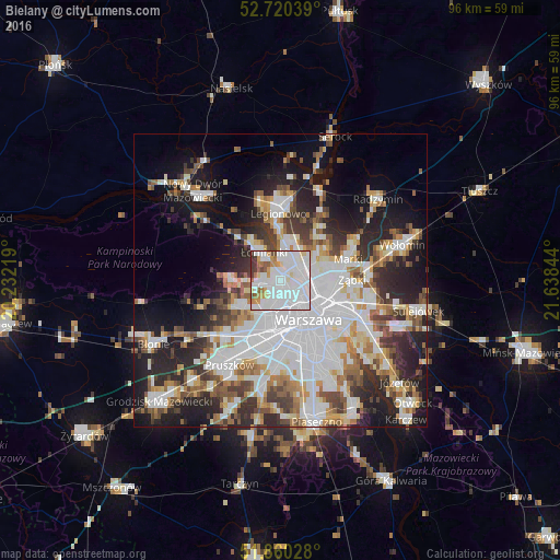
Analysis of Bielany night lights 2016
Square area 10x10 km:
 49.49%
90-99
27.78%80-89
4.04%70-79
6.44%60-69
3.66%50-59
2.65%40-49
2.4%30-39
3.16%20-29
0.38%10-19
0%0-9
0%Square area 50x50 km:
14.19%90-99
9.56%80-89
3.5%70-79
3.92%60-69
4.43%50-59
4.66%40-49
4.58%30-39
4.96%20-29
9.21%10-19
13.58%0-9
27.41%Clear (daylight) street map image can be seen on geolist.org.
Map coordinates:
52° 43' 13.4" North, 20° 13' 55.9" East
52° 17' 32.7" North, 20° 56' 7.1" East
51° 51' 37" North, 21° 38' 18.4" East
Some cities around Bielany sort by population:
• Wola
6.9 km =4.3 mi,  148°
148°
• Targówek
7.7 km =4.8 mi,  90°
90°
• Bemowo
4.6 km =2.9 mi,  203°
203°
• Ochota
8.6 km =5.3 mi,  156°
156°
• Praga Północ
8 km =5 mi,  121°
121°
• Białołeka
4.1 km =2.5 mi,  37°
37°
• Żoliborz
4.3 km =2.7 mi,  126°
126°
• Łomianki
5.7 km =3.5 mi,  324°
324°
776029 (p: 134,854)
Sources (retrieved 2019-11-25):
» NASA, Earths city lights 1995
» NASA city lights 2003
» Earth at Night: Flat Maps 2012, 2016