Bemowo night lights from space
Night Light of Bemowo (Mazovia) from space (Poland) Src. Average luminocity for 10x10km area is 93.1878% and for 50x50km: 44.0011%.
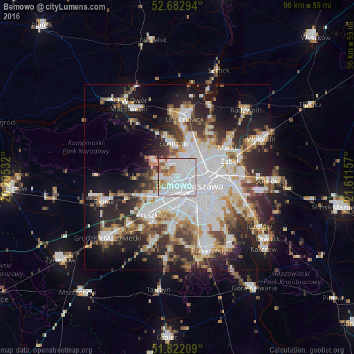
Analysis of Bemowo night lights 2016
Square area 10x10 km:
 56.35%
90-99
23.94%80-89
4.23%70-79
5.56%60-69
4.23%50-59
4.5%40-49
0.93%30-39
0.26%20-29
0%10-19
0%0-9
0%Square area 50x50 km:
14.07%90-99
9.56%80-89
3.58%70-79
3.97%60-69
4.67%50-59
4.63%40-49
4.71%30-39
5.22%20-29
9.98%10-19
14.54%0-9
25.07%Clear (daylight) street map image can be seen on geolist.org.
Map coordinates:
52° 40' 58.6" North, 20° 12' 19.2" East
52° 15' 16.6" North, 20° 54' 30.4" East
51° 49' 19.5" North, 21° 36' 41.7" East
Some cities around Bemowo sort by population:
• Warsaw
7.6 km =4.7 mi,  111°
111°
• Wola
5.7 km =3.5 mi, 106°
• Bielany
4.6 km =2.9 mi,  23°
23°
• Śródmieście
7.9 km =4.9 mi, 111°
• Ochota
6.4 km =4 mi,  125°
125°
• Białołeka
8.6 km =5.3 mi,  30°
30°
• Żoliborz
5.5 km =3.4 mi,  73°
73°
• Ursus
6.8 km =4.2 mi,  194°
194°
776251 (p: 102,393)
Sources (retrieved 2019-11-25):
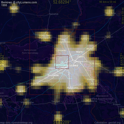
» NASA, Earths city lights 1995
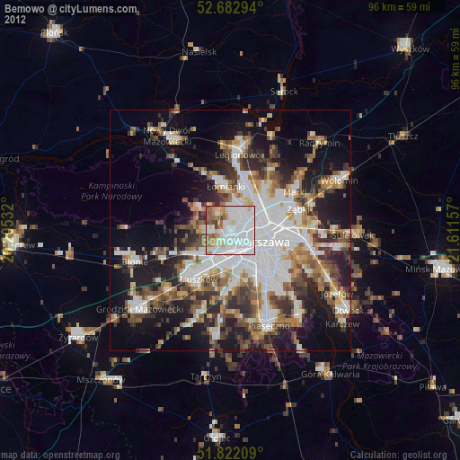
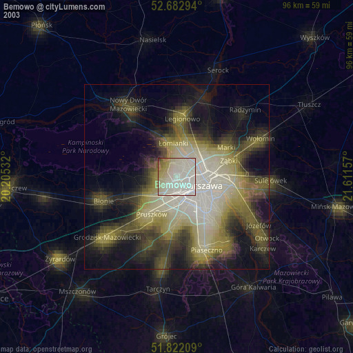
» NASA city lights 2003
» Earth at Night: Flat Maps 2012, 2016