Ratodero night lights from space
Night Light of Ratodero (Sindh) from space (Pakistan) Src. Average luminocity for 10x10km area is 3.1925% and for 50x50km: 3.2215%.
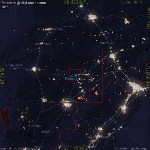
Analysis of Ratodero night lights 2016
Square area 10x10 km:
 0%
0%90-99
0%80-89
0%70-79
0.79%60-69
1.59%50-59
0.79%40-49
0.79%30-39
0.4%20-29
0%10-19
0.4%0-9
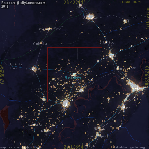
95.24%Square area 50x50 km:
0.02%90-99
0.47%80-89
0.25%70-79
0.27%60-69
0.93%50-59
0.44%40-49
0.61%30-39
0.8%20-29
0.48%10-19
1.07%0-9
94.66%Clear (daylight) street map image can be seen on geolist.org.
Map coordinates:
28° 25' 20.8" North, 67° 35' 9.2" East
27° 48' 8.2" North, 68° 17' 20.5" East
27° 10' 42.7" North, 68° 59' 31.7" East
Some cities around Ratodero sort by population:
• Larkana
28.1 km =17.5 mi,  195°
195°
• Shikarpur
38.3 km =23.8 mi,  63°
63°
• Kambar
37.1 km =23.1 mi,  229°
229°
• Shahdad Kot
37.9 km =23.5 mi,  277°
277°
• Naudero
16.6 km =10.3 mi,  154°
154°
• Garhiyasin
24.8 km =15.4 mi, 62°
• Madeji
16.9 km =10.5 mi,  108°
108°
• Miro Khan
20 km =12.4 mi,  256°
256°
1167031 (p: 47,819)
Sources (retrieved 2019-11-25):
» Earth at Night: Flat Maps 2012, 2016