Kot Malik Barkhurdar night lights from space
Night Light of Kot Malik Barkhurdar (Balochistan) from space (Pakistan) Src. Average luminocity for 10x10km area is 87.8724% and for 50x50km: 9.9257%.
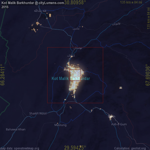
Analysis of Kot Malik Barkhurdar night lights 2016
Square area 10x10 km:
 33.04%
90-99
29.37%80-89
19.23%70-79
5.42%60-69
2.8%50-59
2.27%40-49
3.67%30-39
2.27%20-29
1.92%10-19
0%0-9
0%Square area 50x50 km:
1.77%90-99
1.9%80-89
2.38%70-79
1.14%60-69
0.62%50-59
0.6%40-49
1.41%30-39
1.05%20-29
2.53%10-19
4.99%0-9
81.61%Clear (daylight) street map image can be seen on geolist.org.
Map coordinates:
30° 48' 34.5" North, 66° 17' 2.8" East
30° 12' 13.6" North, 66° 59' 14" East
29° 35' 39.3" North, 67° 41' 25.3" East
Some cities around Kot Malik Barkhurdar sort by population:
• Quetta
2.6 km =1.6 mi,  148°
148°
• Chaman
94.5 km =58.7 mi,  327°
327°
• Mastung
47 km =29.2 mi,  196°
196°
• Pishin
42 km =26.1 mi,  0°
0°
• Mach
50.2 km =31.2 mi,  138°
138°
• Harnai
92.1 km =57.2 mi,  97°
97°
• Alik Ghund
60.3 km =37.5 mi,  58°
58°
• Khadan Khak
92.4 km =57.4 mi,  48°
48°
1172993 (p: 69,359)
Sources (retrieved 2019-11-25):
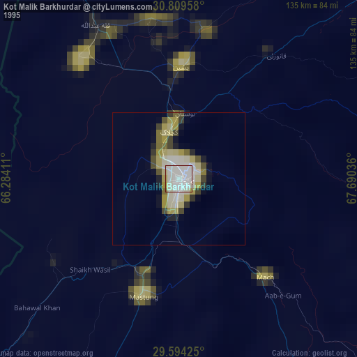
» NASA, Earths city lights 1995
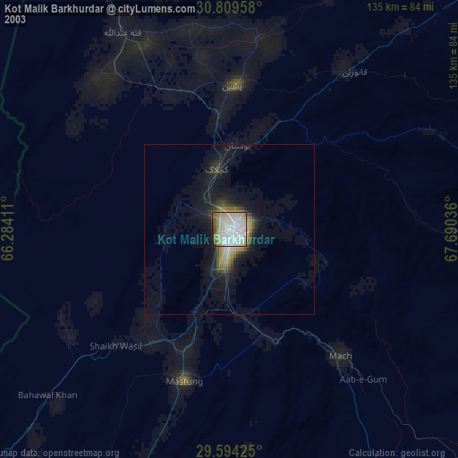
» NASA city lights 2003
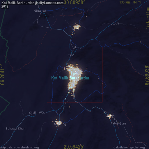
» Earth at Night: Flat Maps 2012, 2016