Pakpattan night lights from space
Night Light of Pakpattan (Punjab) from space (Pakistan) Src. Average luminocity for 10x10km area is 25.7582% and for 50x50km: 2.4478%.
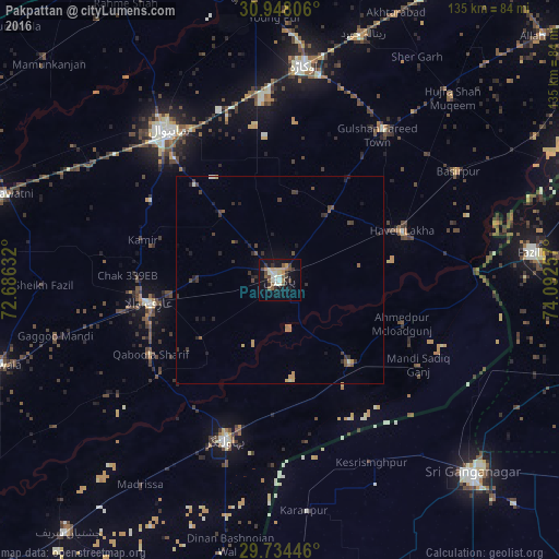
Analysis of Pakpattan night lights 2016
Square area 10x10 km:
 1.28%
1.28%90-99
6.23%80-89
2.01%70-79
4.76%60-69
1.83%50-59
5.86%40-49
3.48%30-39
3.85%20-29
2.93%10-19
24.91%0-9
42.86%Square area 50x50 km:
0.05%90-99
0.32%80-89
0.16%70-79
0.44%60-69
0.23%50-59
0.46%40-49
0.53%30-39
0.67%20-29
0.67%10-19
1.54%0-9
94.93%Clear (daylight) street map image can be seen on geolist.org.
Map coordinates:
30° 56' 53" North, 72° 41' 10.8" East
30° 20' 35.3" North, 73° 23' 22" East
29° 44' 4.1" North, 74° 5' 33.3" East
Some cities around Pakpattan sort by population:
• Sahiwal
45.2 km =28.1 mi,  322°
322°
• Bahawalnagar
40.5 km =25.2 mi,  198°
198°
• Arifwala
31.6 km =19.6 mi,  259°
259°
• Dipalpur
44.2 km =27.5 mi,  34°
34°
• Haveli Lakha
31.5 km =19.6 mi,  67°
67°
• Basirpur
50.4 km =31.3 mi,  58°
58°
• Minchianabad
26.4 km =16.4 mi,  139°
139°
• Chak One Hundred Twenty Nine Left
34.4 km =21.4 mi,  286°
286°
1168555 (p: 126,706)
Sources (retrieved 2019-11-25):
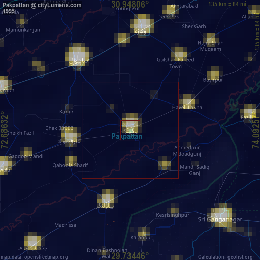
» NASA, Earths city lights 1995
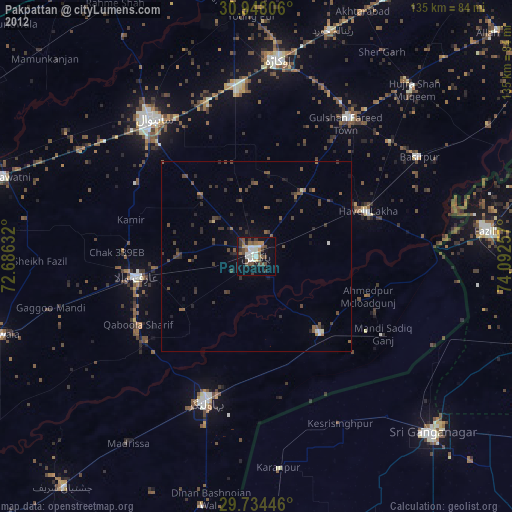
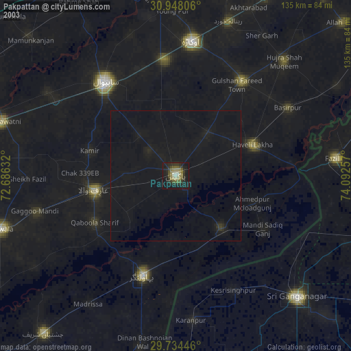
» NASA city lights 2003
» Earth at Night: Flat Maps 2012, 2016