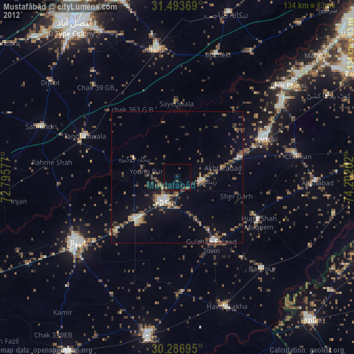
Mustafābād night lights from space
Night Light of Mustafābād (Punjab) from space (Pakistan) Src. Average luminocity for 10x10km area is 7.2972% and for 50x50km: 7.018%.
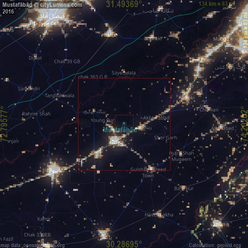
Analysis of Mustafābād night lights 2016
Square area 10x10 km:
 0%
0%90-99
0%80-89
0%70-79
1.05%60-69
0.35%50-59
1.22%40-49
0.52%30-39
2.27%20-29
2.1%10-19
15.73%0-9
76.75%Square area 50x50 km:
0.26%90-99
1.17%80-89
0.43%70-79
0.83%60-69
0.92%50-59
1.05%40-49
1.67%30-39
1.27%20-29
1.79%10-19
6.01%0-9
84.6%Clear (daylight) street map image can be seen on geolist.org.
Map coordinates:
31° 29' 37.3" North, 72° 47' 44.8" East
30° 53' 32" North, 73° 29' 56" East
30° 17' 13" North, 74° 12' 7.3" East
Some cities around Mustafābād sort by population:
• Sahiwal
45.5 km =28.3 mi,  236°
236°
• Okara
10.2 km =6.3 mi,  206°
206°
• Dipalpur
28.8 km =17.9 mi,  149°
149°
• Pattoki
36.7 km =22.8 mi,  67°
67°
• Hujra Shah Muqim
35.2 km =21.9 mi,  118°
118°
• Chunian
46.5 km =28.9 mi,  79°
79°
• Tandlianwala
38.3 km =23.8 mi,  294°
294°
• Renala Khurd
9.6 km =6 mi,  98°
98°
1169620 (p: 45,795)
Sources (retrieved 2019-11-25):
» Earth at Night: Flat Maps 2012, 2016