Mamu Kanjan night lights from space
Night Light of Mamu Kanjan (Punjab) from space (Pakistan) Src. Average luminocity for 10x10km area is 1.5315% and for 50x50km: 1.9806%.

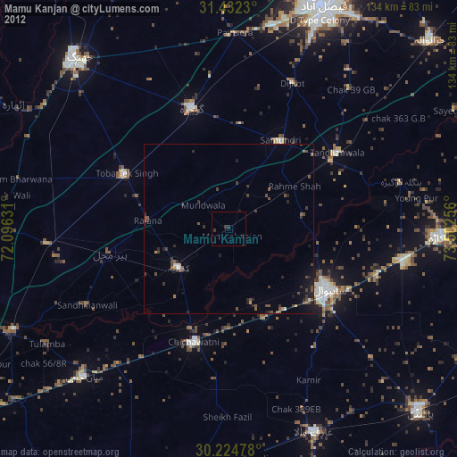
Analysis of Mamu Kanjan night lights 2016
Square area 10x10 km:
 0%
0%90-99
0%80-89
0%70-79
0%60-69
0%50-59
0%40-49
2.1%30-39
0.35%20-29
1.05%10-19
0.7%0-9
95.8%Square area 50x50 km:
0.02%90-99
0.12%80-89
0.03%70-79
0.15%60-69
0.14%50-59
0.25%40-49
1.07%30-39
0.68%20-29
0.87%10-19
1.42%0-9
95.25%Clear (daylight) street map image can be seen on geolist.org.
Map coordinates:
31° 25' 56.3" North, 72° 5' 46.7" East
30° 49' 49.6" North, 72° 47' 57.9" East
30° 13' 29.2" North, 73° 30' 9.2" East
Some cities around Mamu Kanjan sort by population:
• Sahiwal
34.2 km =21.3 mi,  122°
122°
• Gojra
37.1 km =23.1 mi,  342°
342°
• Kamalia
18.6 km =11.6 mi,  231°
231°
• Chichawatni
35 km =21.7 mi,  197°
197°
• Toba Tek Singh
34 km =21.1 mi,  297°
297°
• Tandlianwala
39 km =24.2 mi,  54°
54°
• Chak Azam Sahu
23.5 km =14.6 mi,  111°
111°
• Pir Mahal
35.6 km =22.1 mi,  258°
258°
1171198 (p: 31,914)
Sources (retrieved 2019-11-25):
» Earth at Night: Flat Maps 2012, 2016