Kotri night lights from space
Night Light of Kotri (Sindh) from space (Pakistan) Src. Average luminocity for 10x10km area is 75.0595% and for 50x50km: 16.0399%.
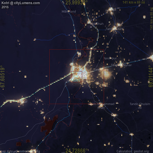
Analysis of Kotri night lights 2016
Square area 10x10 km:
 14.68%
90-99
18.65%80-89
20.44%70-79
9.13%60-69
8.53%50-59
12.3%40-49
6.55%30-39
4.76%20-29
4.96%10-19
0%0-9
0%Square area 50x50 km:
1.38%90-99
2.12%80-89
3.19%70-79
1.96%60-69
1.88%50-59
3.16%40-49
2.75%30-39
2.56%20-29
4.2%10-19
9.79%0-9
67.02%Clear (daylight) street map image can be seen on geolist.org.
Map coordinates:
25° 59' 57.6" North, 67° 36' 18.7" East
25° 21' 56.4" North, 68° 18' 29.9" East
24° 43' 43.2" North, 69° 0' 41.2" East
Some cities around Kotri sort by population:
• Hyderabad
7.2 km =4.5 mi,  65°
65°
• Tando Allahyar
42.4 km =26.3 mi,  75°
75°
• Tando Muhammad Khan
35.4 km =22 mi,  139°
139°
• Matli
50.1 km =31.1 mi, 135°
• Hala
51.2 km =31.8 mi,  12°
12°
• Tando Jam
23.3 km =14.5 mi, 72°
• Matiari
29.2 km =18.1 mi,  28°
28°
• Chamber
51.2 km =31.8 mi,  98°
98°
1172904 (p: 72,672)
Sources (retrieved 2019-11-25):
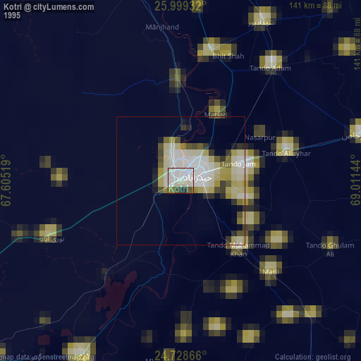
» NASA, Earths city lights 1995
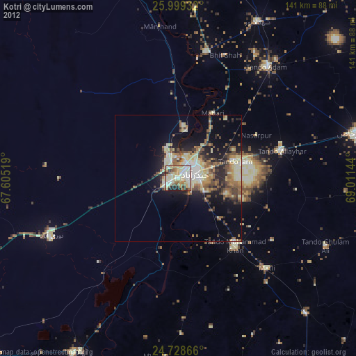
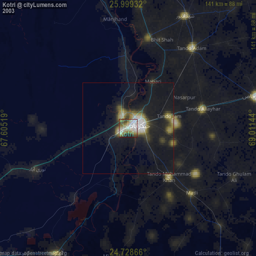
» NASA city lights 2003
» Earth at Night: Flat Maps 2012, 2016