Hyderabad night lights from space
Night Light of Hyderabad (Sindh) from space (Pakistan) Src. Average luminocity for 10x10km area is 87.1964% and for 50x50km: 18.5417%.
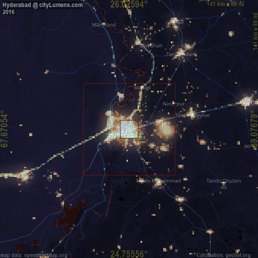
Analysis of Hyderabad night lights 2016
Square area 10x10 km:
 27.98%
90-99
31.35%80-89
16.87%70-79
8.73%60-69
4.37%50-59
6.35%40-49
2.18%30-39
0.99%20-29
1.19%10-19
0%0-9
0%Square area 50x50 km:
1.45%90-99
2.36%80-89
3.89%70-79
2.22%60-69
2.31%50-59
3.59%40-49
3.29%30-39
3.12%20-29
4.9%10-19
11.11%0-9
61.78%Clear (daylight) street map image can be seen on geolist.org.
Map coordinates:
26° 1' 33.4" North, 67° 40' 13.9" East
25° 23' 32.7" North, 68° 22' 25.2" East
24° 45' 20" North, 69° 4' 36.4" East
Some cities around Hyderabad sort by population:
• Tando Allahyar
35.3 km =21.9 mi,  77°
77°
• Kotri
7.2 km =4.5 mi,  245°
245°
• Tando Muhammad Khan
34.1 km =21.2 mi,  151°
151°
• Hala
47.2 km =29.3 mi,  5°
5°
• Tando Jam
16.1 km =10 mi, 75°
• Bhit Shah
47.4 km =29.5 mi, 14°
• Matiari
23.9 km =14.9 mi,  17°
17°
• Chamber
45.4 km =28.2 mi,  104°
104°
1176734 (p: 1,386,330)
Sources (retrieved 2019-11-25):
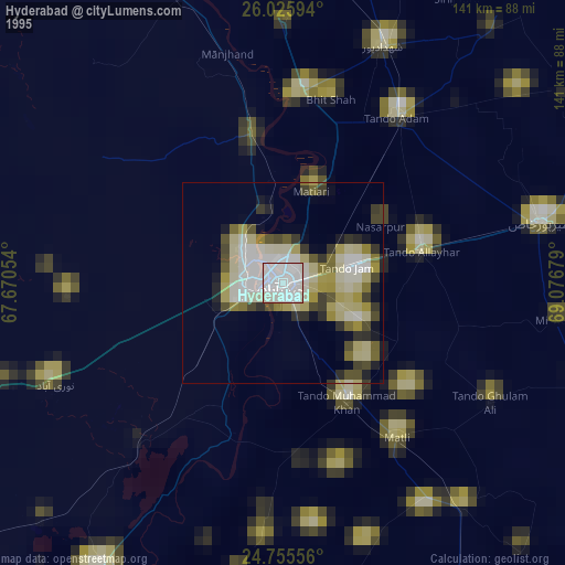
» NASA, Earths city lights 1995
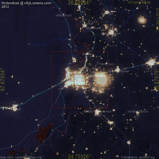
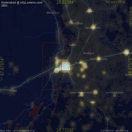
» NASA city lights 2003
» Earth at Night: Flat Maps 2012, 2016