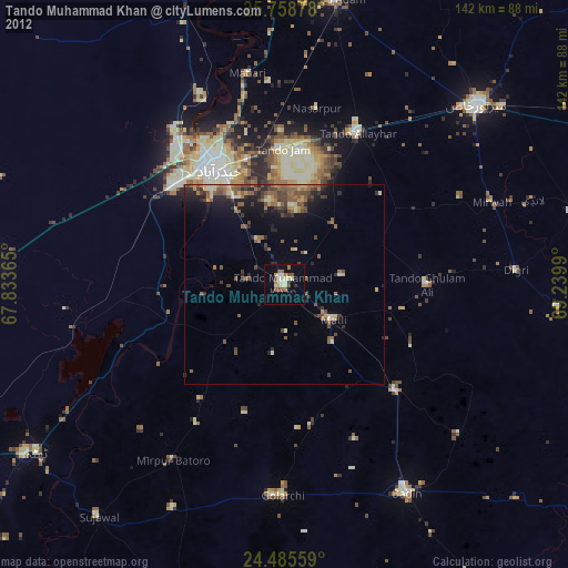
Tando Muhammad Khan night lights from space
Night Light of Tando Muhammad Khan (Sindh) from space (Pakistan) Src. Average luminocity for 10x10km area is 13.2462% and for 50x50km: 5.6316%.
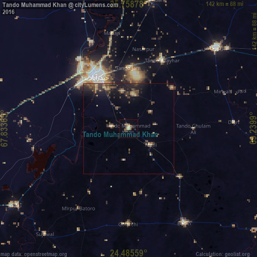
Analysis of Tando Muhammad Khan night lights 2016
Square area 10x10 km:
 0%
0%90-99
1.33%80-89
2.65%70-79
2.08%60-69
0.95%50-59
3.79%40-49
1.7%30-39
2.08%20-29
3.98%10-19
0.95%0-9
80.49%Square area 50x50 km:
0.11%90-99
0.27%80-89
0.57%70-79
0.62%60-69
0.64%50-59
1.42%40-49
1.71%30-39
1.54%20-29
2.17%10-19
4%0-9
86.95%Clear (daylight) street map image can be seen on geolist.org.
Map coordinates:
25° 45' 31.6" North, 67° 50' 1.1" East
25° 7' 25.8" North, 68° 32' 12.4" East
24° 29' 8.1" North, 69° 14' 23.6" East
Some cities around Tando Muhammad Khan sort by population:
• Hyderabad
34.1 km =21.2 mi,  331°
331°
• Kotri
35.4 km =22 mi,  319°
319°
• Matli
15 km =9.3 mi,  126°
126°
• Talhar
38.6 km =24 mi, 133°
• Chamber
33.5 km =20.8 mi,  55°
55°
• Daromehar
51.4 km =31.9 mi,  224°
224°
• Rajo Khanani
35.5 km =22.1 mi,  115°
115°
• Kario Ghanwar
35.8 km =22.2 mi,  168°
168°
1163952 (p: 72,659)
Sources (retrieved 2019-11-25):
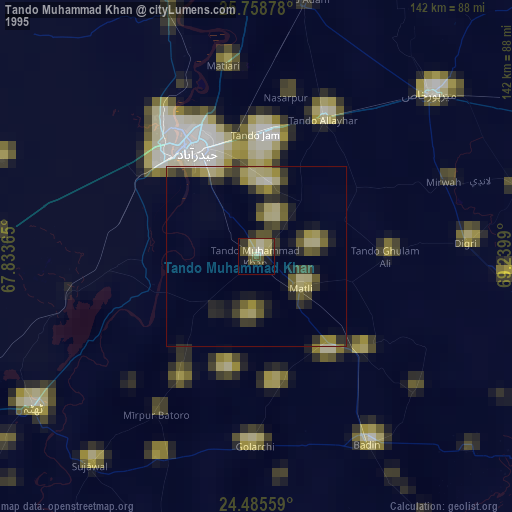
» NASA, Earths city lights 1995
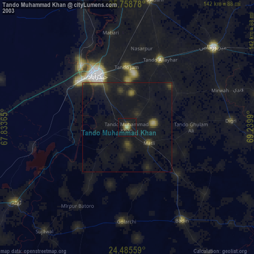
» NASA city lights 2003
» Earth at Night: Flat Maps 2012, 2016