Daur night lights from space
Night Light of Daur (Sindh) from space (Pakistan) Src. Average luminocity for 10x10km area is 0.1875% and for 50x50km: 1.8652%.
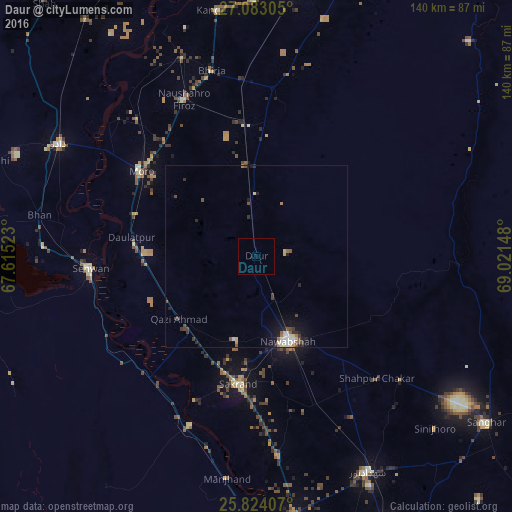
Analysis of Daur night lights 2016
Square area 10x10 km:
 0%
0%90-99
0%80-89
0%70-79
0%60-69
0%50-59
0%40-49
0%30-39
0%20-29
0%10-19
0.95%0-9
99.05%Square area 50x50 km:
0.22%90-99
0.29%80-89
0.28%70-79
0.08%60-69
0.2%50-59
0.26%40-49
0.42%30-39
0.35%20-29
0.42%10-19
1.06%0-9
96.41%Clear (daylight) street map image can be seen on geolist.org.
Map coordinates:
27° 4' 59" North, 67° 36' 54.8" East
26° 27' 19" North, 68° 19' 6.1" East
25° 49' 26.7" North, 69° 1' 17.3" East
Some cities around Daur sort by population:
• Nawabshah
25.5 km =15.8 mi,  160°
160°
• Moro
39.2 km =24.4 mi,  306°
306°
• Sakrand
35.5 km =22.1 mi,  187°
187°
• Pad Idan
35.5 km =22.1 mi,  357°
357°
• Daulatpur
35 km =21.7 mi,  278°
278°
• Darya Khan Marri
24.9 km =15.5 mi,  352°
352°
• Bandhi
14.8 km =9.2 mi, 353°
• Jām Sāhib
35.7 km =22.2 mi,  119°
119°
1180374 (p: 17,577)
Sources (retrieved 2019-11-25):
» Earth at Night: Flat Maps 2012, 2016