Daulatpur night lights from space
Night Light of Daulatpur (Sindh) from space (Pakistan) Src. Average luminocity for 10x10km area is 6.0871% and for 50x50km: 2.666%.
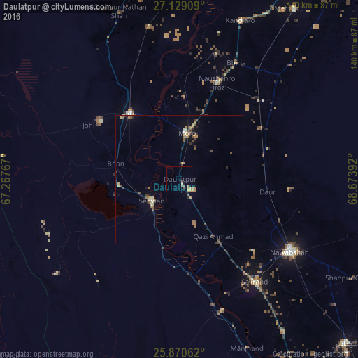
Analysis of Daulatpur night lights 2016
Square area 10x10 km:
 0%
0%90-99
0%80-89
0.76%70-79
3.79%60-69
0%50-59
0.19%40-49
2.84%30-39
0%20-29
0%10-19
0.76%0-9
91.67%Square area 50x50 km:
0.02%90-99
0.13%80-89
0.48%70-79
0.42%60-69
0.58%50-59
0.51%40-49
0.59%30-39
0.28%20-29
0.34%10-19
0.73%0-9
95.93%Clear (daylight) street map image can be seen on geolist.org.
Map coordinates:
27° 7' 44.7" North, 67° 16' 3.6" East
26° 30' 5.7" North, 67° 58' 14.8" East
25° 52' 14.2" North, 68° 40' 26.1" East
Some cities around Daulatpur sort by population:
• Dadu
31.9 km =19.8 mi,  322°
322°
• Moro
18.2 km =11.3 mi,  9°
9°
• Sehwan
13.8 km =8.6 mi,  231°
231°
• Naushahro Firoz
40.6 km =25.2 mi,  21°
21°
• Daur
35 km =21.7 mi,  98°
98°
• Bhan
25.6 km =15.9 mi,  284°
284°
• Darya Khan Marri
37 km =23 mi,  58°
58°
• Bandhi
34.3 km =21.3 mi,  73°
73°
1180397 (p: 14,574)
Sources (retrieved 2019-11-25):
» Earth at Night: Flat Maps 2012, 2016