Bozdar Wada night lights from space
Night Light of Bozdar Wada (Sindh) from space (Pakistan) Src. Average luminocity for 10x10km area is 0.7633% and for 50x50km: 3.7786%.
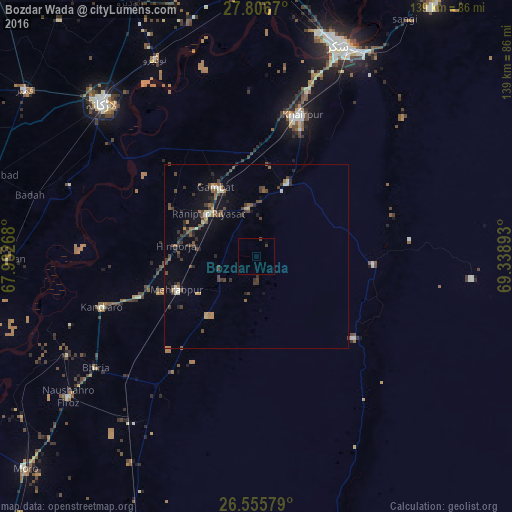
Analysis of Bozdar Wada night lights 2016
Square area 10x10 km:
 0%
0%90-99
0%80-89
0%70-79
0%60-69
0%50-59
0%40-49
0.76%30-39
0.76%20-29
0%10-19
0%0-9
98.48%Square area 50x50 km:
0.08%90-99
0.38%80-89
0.24%70-79
0.32%60-69
0.46%50-59
0.75%40-49
1.32%30-39
1.02%20-29
1.03%10-19
1.65%0-9
92.74%Clear (daylight) street map image can be seen on geolist.org.
Map coordinates:
27° 48' 24.1" North, 67° 55' 57.6" East
27° 10' 58.8" North, 68° 38' 8.9" East
26° 33' 20.8" North, 69° 20' 20.1" East
Some cities around Bozdar Wada sort by population:
• Gambat
21.9 km =13.6 mi,  328°
328°
• Setharja Old
16.8 km =10.4 mi,  281°
281°
• Kot Diji
19 km =11.8 mi,  22°
22°
• Ranipur
17.3 km =10.7 mi,  312°
312°
• Hingorja
22 km =13.7 mi, 278°
• Sobhodero
27.2 km =16.9 mi,  299°
299°
• Karaundi
39.1 km =24.3 mi,  215°
215°
• Kandiari
31.8 km =19.8 mi,  200°
200°
1182295 (p: 9,175)
Sources (retrieved 2019-11-25):
» Earth at Night: Flat Maps 2012, 2016