Taligaman night lights from space
Night Light of Taligaman (Caraga) from space (Philippines) Src. Average luminocity for 10x10km area is 0.0823% and for 50x50km: 1.726%.
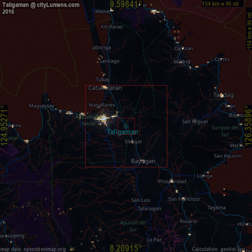
Analysis of Taligaman night lights 2016
Square area 10x10 km:
 0%
0%90-99
0%80-89
0%70-79
0%60-69
0%50-59
0%40-49
0%30-39
0%20-29
0%10-19
0%0-9
100%Square area 50x50 km:
0.08%90-99
0.14%80-89
0.33%70-79
0.26%60-69
0.16%50-59
0.14%40-49
0.48%30-39
0.37%20-29
0.28%10-19
1.21%0-9
96.56%Clear (daylight) street map image can be seen on geolist.org.
Map coordinates:
9° 35' 54.3" North, 124° 57' 9.8" East
8° 54' 16" North, 125° 39' 21" East
8° 12' 32.9" North, 126° 21' 32.3" East
Some cities around Taligaman sort by population:
• Butuan
13.3 km =8.3 mi,  291°
291°
• Libertad
17.5 km =10.9 mi,  284°
284°
• Bayugan
20.6 km =12.8 mi,  143°
143°
• Cabadbaran
27.6 km =17.1 mi,  331°
331°
• Buenavista
28.3 km =17.6 mi, 286°
• Tungao
17 km =10.6 mi,  214°
214°
• Magallanes
19.9 km =12.4 mi,  310°
310°
• Esperanza
25.3 km =15.7 mi,  182°
182°
1683949 (p: 7,430)
Sources (retrieved 2019-11-25):
» Earth at Night: Flat Maps 2012, 2016