Salvacion night lights from space
Night Light of Salvacion (Western Visayas) from space (Philippines) Src. Average luminocity for 10x10km area is 17.2149% and for 50x50km: 5.1055%.
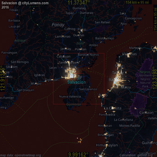
Analysis of Salvacion night lights 2016
Square area 10x10 km:
 2.69%
2.69%90-99
2.27%80-89
2.69%70-79
3.72%60-69
1.03%50-59
0%40-49
1.45%30-39
2.48%20-29
5.17%10-19
17.36%0-9
61.16%Square area 50x50 km:
0.37%90-99
0.45%80-89
1.3%70-79
1.11%60-69
0.5%50-59
0.31%40-49
0.82%30-39
0.59%20-29
1.45%10-19
3.96%0-9
89.14%Clear (daylight) street map image can be seen on geolist.org.
Map coordinates:
11° 22' 24.5" North, 121° 54' 48.8" East
10° 40' 60" North, 122° 37' 0" East
9° 59' 29.8" North, 123° 19' 11.3" East
Some cities around Salvacion sort by population:
• Iloilo
5.9 km =3.7 mi,  284°
284°
• Oton
15.7 km =9.8 mi,  273°
273°
• Dumangas
18.9 km =11.7 mi,  33°
33°
• Santa Barbara
17.9 km =11.1 mi,  329°
329°
• Jordan
3.6 km =2.2 mi,  218°
218°
• Pavia
12.9 km =8 mi,  323°
323°
• Cabano
14.1 km =8.8 mi,  139°
139°
• Ungca
10.4 km =6.5 mi, 315°
1690729 (p: 5,565)
Sources (retrieved 2019-11-25):
» Earth at Night: Flat Maps 2012, 2016