Iloilo night lights from space
Night Light of Iloilo (Western Visayas) from space (Philippines) Src. Average luminocity for 10x10km area is 50.6632% and for 50x50km: 4.8822%.
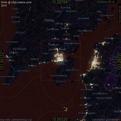
Analysis of Iloilo night lights 2016
Square area 10x10 km:
 9.09%
9.09%90-99
10.74%80-89
11.57%70-79
11.78%60-69
3.51%50-59
1.45%40-49
3.51%30-39
3.1%20-29
12.81%10-19
24.79%0-9
7.64%Square area 50x50 km:
0.37%90-99
0.45%80-89
1.24%70-79
1.05%60-69
0.49%50-59
0.26%40-49
0.77%30-39
0.53%20-29
1.39%10-19
3.96%0-9
89.49%Clear (daylight) street map image can be seen on geolist.org.
Map coordinates:
11° 23' 13.3" North, 121° 51' 40.8" East
10° 41' 49" North, 122° 33' 52" East
10° 0' 18.9" North, 123° 16' 3.3" East
Some cities around Iloilo sort by population:
• Oton
9.9 km =6.2 mi,  267°
267°
• Trapiche
14.5 km =9 mi,  264°
264°
• Santa Barbara
14.4 km =8.9 mi,  346°
346°
• San Miguel
14.2 km =8.8 mi,  310°
310°
• Jordan
5.5 km =3.4 mi,  140°
140°
• Pavia
9 km =5.6 mi, 346°
• Ungca
6.1 km =3.8 mi, 345°
• Salvacion
5.9 km =3.7 mi,  104°
104°
1711005 (p: 387,681)
Sources (retrieved 2019-11-25):
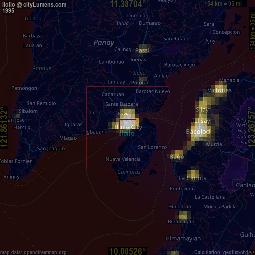
» NASA, Earths city lights 1995
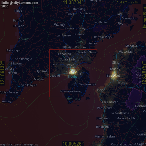
» NASA city lights 2003
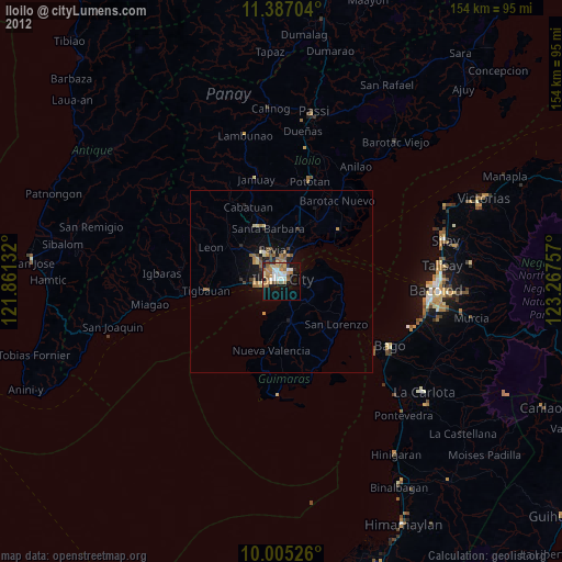
» Earth at Night: Flat Maps 2012, 2016