Ungca night lights from space
Night Light of Ungca (Western Visayas) from space (Philippines) Src. Average luminocity for 10x10km area is 58.0165% and for 50x50km: 5.0152%.
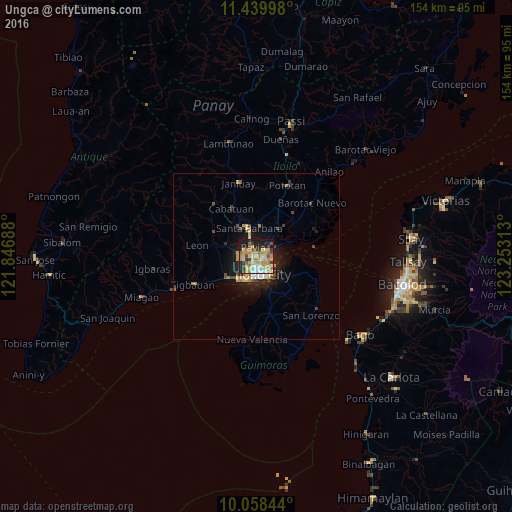
Analysis of Ungca night lights 2016
Square area 10x10 km:
 5.99%
5.99%90-99
4.75%80-89
20.25%70-79
16.94%60-69
8.06%50-59
3.93%40-49
7.23%30-39
5.17%20-29
12.81%10-19
14.46%0-9
0.41%Square area 50x50 km:
0.37%90-99
0.45%80-89
1.24%70-79
1.09%60-69
0.55%50-59
0.3%40-49
0.81%30-39
0.58%20-29
1.44%10-19
3.96%0-9
89.23%Clear (daylight) street map image can be seen on geolist.org.
Map coordinates:
11° 26' 23.9" North, 121° 50' 48.8" East
10° 45' 0" North, 122° 33' 0" East
10° 3' 30.4" North, 123° 15' 11.3" East
Some cities around Ungca sort by population:
• Iloilo
6.1 km =3.8 mi,  165°
165°
• Oton
10.5 km =6.5 mi,  232°
232°
• Trapiche
14.8 km =9.2 mi,  240°
240°
• Santa Barbara
8.3 km =5.2 mi,  348°
348°
• San Miguel
9.8 km =6.1 mi,  289°
289°
• Jordan
11.4 km =7.1 mi,  153°
153°
• Pavia
2.9 km =1.8 mi, 350°
• Salvacion
10.4 km =6.5 mi,  135°
135°
1680285 (p: 5,599)
Sources (retrieved 2019-11-25):
» Earth at Night: Flat Maps 2012, 2016