Palampas night lights from space
Night Light of Palampas (Western Visayas) from space (Philippines) Src. Average luminocity for 10x10km area is 13.1715% and for 50x50km: 1.1925%.
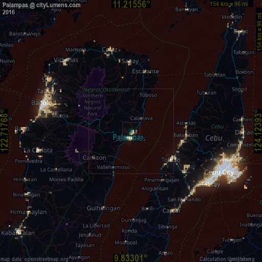
Analysis of Palampas night lights 2016
Square area 10x10 km:
 1.24%
1.24%90-99
1.24%80-89
4.13%70-79
1.65%60-69
1.03%50-59
1.45%40-49
1.03%30-39
3.93%20-29
0.83%10-19
1.65%0-9
81.82%Square area 50x50 km:
0.1%90-99
0.12%80-89
0.24%70-79
0.19%60-69
0.06%50-59
0.11%40-49
0.12%30-39
0.34%20-29
0.25%10-19
0.21%0-9
98.27%Clear (daylight) street map image can be seen on geolist.org.
Map coordinates:
11° 12' 56" North, 122° 43' 3.6" East
10° 31' 30.2" North, 123° 25' 14.9" East
9° 49' 58.8" North, 124° 7' 26.1" East
Some cities around Palampas sort by population:
• Ualog
6.2 km =3.9 mi,  331°
331°
• Codcod
19.9 km =12.4 mi,  249°
249°
• Buluangan
17.8 km =11.1 mi,  210°
210°
• Quezon
20.1 km =12.5 mi,  240°
240°
• Guadalupe
9.4 km =5.8 mi, 213°
• Calatrava
10.4 km =6.5 mi,  41°
41°
• Minapasoc
20.9 km =13 mi,  337°
337°
• Punao
4.7 km =2.9 mi, 342°
1696312 (p: 9,037)
Sources (retrieved 2019-11-25):
» Earth at Night: Flat Maps 2012, 2016