Punao night lights from space
Night Light of Punao (Western Visayas) from space (Philippines) Src. Average luminocity for 10x10km area is 3.5393% and for 50x50km: 0.9529%.
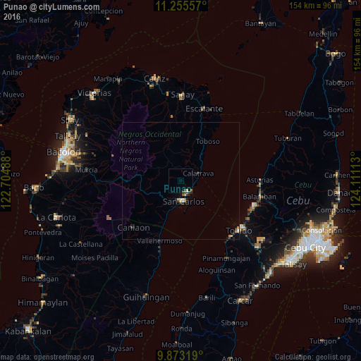
Analysis of Punao night lights 2016
Square area 10x10 km:
 0.21%
0.21%90-99
0.21%80-89
0.83%70-79
0%60-69
0.62%50-59
0.62%40-49
0.62%30-39
1.45%20-29
0%10-19
0%0-9
95.45%Square area 50x50 km:
0.07%90-99
0.07%80-89
0.22%70-79
0.15%60-69
0.06%50-59
0.08%40-49
0.1%30-39
0.3%20-29
0.15%10-19
0.15%0-9
98.65%Clear (daylight) street map image can be seen on geolist.org.
Map coordinates:
11° 15' 20.1" North, 122° 42' 17.6" East
10° 33' 54.6" North, 123° 24' 28.8" East
9° 52' 23.5" North, 124° 6' 40.1" East
Some cities around Punao sort by population:
• Ualog
1.9 km =1.2 mi,  301°
301°
• Codcod
20.7 km =12.9 mi,  236°
236°
• Toboso
20.4 km =12.7 mi,  35°
35°
• Guadalupe
12.9 km =8 mi,  197°
197°
• Calatrava
8.9 km =5.5 mi,  68°
68°
• Palampas
4.7 km =2.9 mi,  162°
162°
• Minapasoc
16.2 km =10.1 mi,  336°
336°
• Bugang
19.7 km =12.2 mi,  355°
355°
1692479 (p: 5,997)
Sources (retrieved 2019-11-25):
» Earth at Night: Flat Maps 2012, 2016