Nabua night lights from space
Night Light of Nabua (Bicol) from space (Philippines) Src. Average luminocity for 10x10km area is 4.6033% and for 50x50km: 2.1648%.
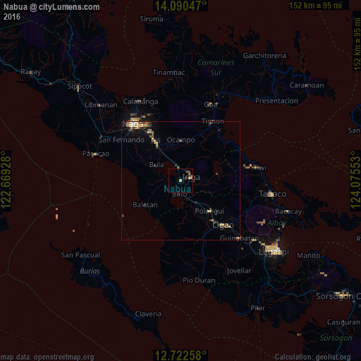
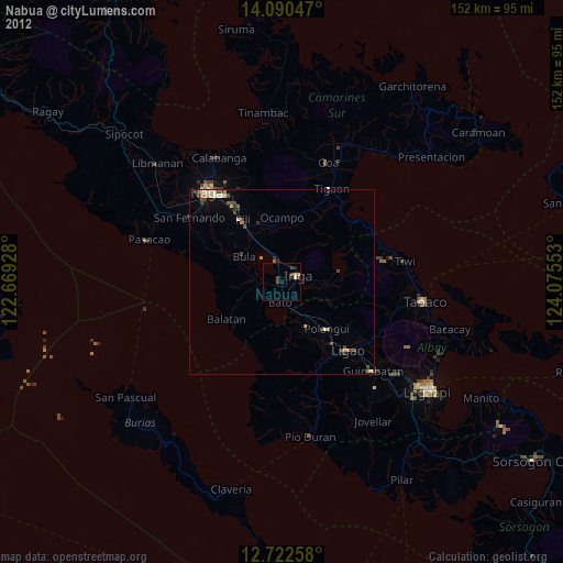
Analysis of Nabua night lights 2016
Square area 10x10 km:
 0%
0%90-99
0%80-89
1.65%70-79
0%60-69
1.45%50-59
0.62%40-49
2.07%30-39
0%20-29
2.48%10-19
0%0-9
91.74%Square area 50x50 km:
0.1%90-99
0.12%80-89
0.37%70-79
0.5%60-69
0.17%50-59
0.29%40-49
0.64%30-39
0.47%20-29
0.41%10-19
1.06%0-9
95.86%Clear (daylight) street map image can be seen on geolist.org.
Map coordinates:
14° 5' 25.7" North, 122° 40' 9.4" East
13° 24' 27" North, 123° 22' 20.6" East
12° 43' 21.3" North, 124° 4' 31.9" East
Some cities around Nabua sort by population:
• Iriga City
5.1 km =3.2 mi,  56°
56°
• Baao
5.3 km =3.3 mi,  351°
351°
• Bato
6.1 km =3.8 mi,  184°
184°
• Bula
12.4 km =7.7 mi,  304°
304°
• Agupit
5.4 km =3.4 mi,  287°
287°
• Buluang
11.7 km =7.3 mi,  196°
196°
• Santa Justina
11 km =6.8 mi,  96°
96°
• Santo Domingo
8.4 km =5.2 mi,  80°
80°
1698921 (p: 25,687)
Sources (retrieved 2019-11-25):
» Earth at Night: Flat Maps 2012, 2016