Bula night lights from space
Night Light of Bula (Bicol) from space (Philippines) Src. Average luminocity for 10x10km area is 0.3864% and for 50x50km: 2.4291%.
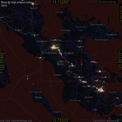
Analysis of Bula night lights 2016
Square area 10x10 km:
 0%
0%90-99
0%80-89
0%70-79
0%60-69
0%50-59
0%40-49
0%30-39
0.83%20-29
0%10-19
0%0-9
99.17%Square area 50x50 km:
0.1%90-99
0.13%80-89
0.35%70-79
0.56%60-69
0.22%50-59
0.25%40-49
0.71%30-39
0.45%20-29
0.54%10-19
1.69%0-9
95%Clear (daylight) street map image can be seen on geolist.org.
Map coordinates:
14° 9' 10.4" North, 122° 34' 29.6" East
13° 28' 12.4" North, 123° 16' 40.8" East
12° 47' 7.3" North, 123° 58' 52.1" East
Some cities around Bula sort by population:
• Iriga City
15 km =9.3 mi,  106°
106°
• Nabua
12.4 km =7.7 mi,  124°
124°
• Baao
9.6 km =6 mi,  100°
100°
• Bato
16.3 km =10.1 mi,  143°
143°
• Milaor
17.7 km =11 mi,  322°
322°
• Agupit
7.3 km =4.5 mi, 136°
• San Fernando
17.8 km =11.1 mi,  306°
306°
• Antipolo
14.1 km =8.8 mi,  297°
297°
1723085 (p: 13,694)
Sources (retrieved 2019-11-25):
» Earth at Night: Flat Maps 2012, 2016