Iriga City night lights from space
Night Light of Iriga City (Bicol) from space (Philippines) Src. Average luminocity for 10x10km area is 4.907% and for 50x50km: 2.3339%.
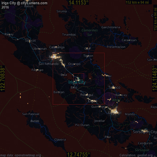
Analysis of Iriga City night lights 2016
Square area 10x10 km:
 0%
0%90-99
0%80-89
1.65%70-79
0%60-69
1.45%50-59
1.03%40-49
2.07%30-39
0%20-29
2.48%10-19
0%0-9
91.32%Square area 50x50 km:
0.1%90-99
0.13%80-89
0.35%70-79
0.6%60-69
0.27%50-59
0.34%40-49
0.62%30-39
0.45%20-29
0.48%10-19
1.3%0-9
95.37%Clear (daylight) street map image can be seen on geolist.org.
Map coordinates:
14° 6' 55.1" North, 122° 42' 30.2" East
13° 25' 56.6" North, 123° 24' 41.4" East
12° 44' 51.2" North, 124° 6' 52.7" East
Some cities around Iriga City sort by population:
• Libon
15 km =9.3 mi,  168°
168°
• Buhi
11.4 km =7.1 mi,  90°
90°
• Nabua
5.1 km =3.2 mi,  236°
236°
• Baao
5.6 km =3.5 mi,  296°
296°
• Bato
10 km =6.2 mi,  208°
208°
• Agupit
9.4 km =5.8 mi,  263°
263°
• Santa Justina
7.8 km =4.8 mi,  120°
120°
• Santo Domingo
4.2 km =2.6 mi,  108°
108°
1710544 (p: 94,846)
Sources (retrieved 2019-11-25):
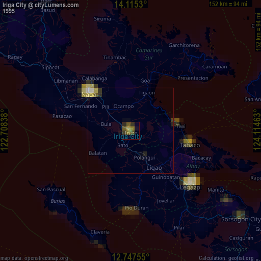
» NASA, Earths city lights 1995
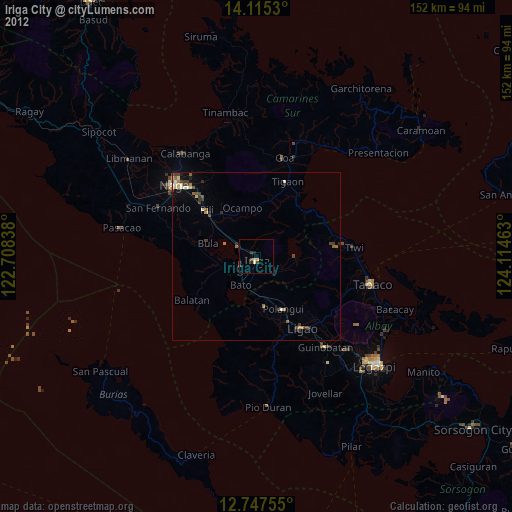
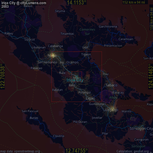
» NASA city lights 2003
» Earth at Night: Flat Maps 2012, 2016