Mati night lights from space
Night Light of Mati (Davao) from space (Philippines) Src. Average luminocity for 10x10km area is 13.71% and for 50x50km: 0.8041%.
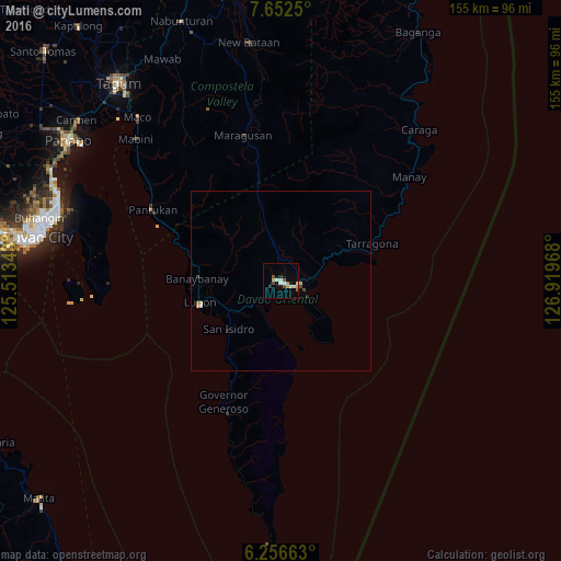
Analysis of Mati night lights 2016
Square area 10x10 km:
 1.52%
1.52%90-99
1.73%80-89
3.03%70-79
3.25%60-69
0%50-59
0.87%40-49
2.6%30-39
1.73%20-29
0.87%10-19
1.3%0-9
83.12%Square area 50x50 km:
0.06%90-99
0.14%80-89
0.16%70-79
0.16%60-69
0.03%50-59
0.03%40-49
0.15%30-39
0.13%20-29
0.07%10-19
0.09%0-9
98.98%Clear (daylight) street map image can be seen on geolist.org.
Map coordinates:
7° 39' 9" North, 125° 30' 48.3" East
6° 57' 18.3" North, 126° 12' 59.6" East
6° 15' 23.9" North, 126° 55' 10.8" East
Some cities around Mati sort by population:
• Lupon
23.7 km =14.7 mi,  254°
254°
• Manay
45.9 km =28.5 mi,  50°
50°
• Batobato
20.5 km =12.7 mi,  225°
225°
• Sigaboy
37 km =23 mi,  205°
205°
• Tibanbang
38 km =23.6 mi,  198°
198°
• Magnaga
42.9 km =26.7 mi,  303°
303°
• San Ignacio
35.1 km =21.8 mi,  58°
58°
• La Union
31.3 km =19.4 mi, 206°
1700360 (p: 105,908)
Sources (retrieved 2019-11-25):
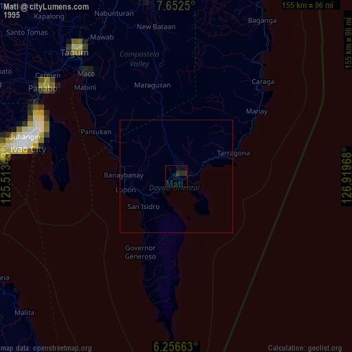
» NASA, Earths city lights 1995
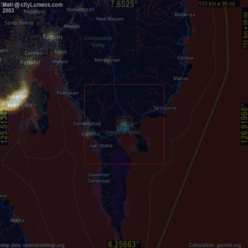
» NASA city lights 2003
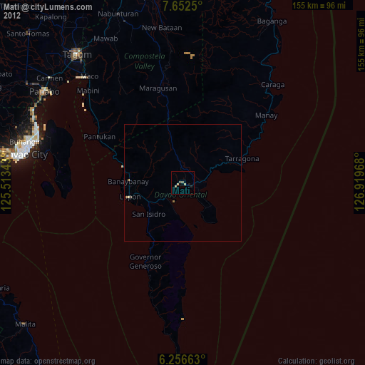
» Earth at Night: Flat Maps 2012, 2016