Damilag night lights from space
Night Light of Damilag (Northern Mindanao) from space (Philippines) Src. Average luminocity for 10x10km area is 2.0537% and for 50x50km: 5.2836%.
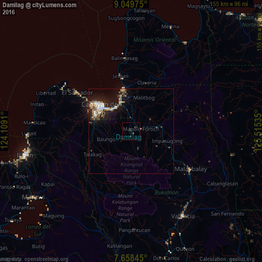
Analysis of Damilag night lights 2016
Square area 10x10 km:
 0%
0%90-99
0%80-89
0%70-79
0%60-69
0.21%50-59
0.62%40-49
1.03%30-39
1.03%20-29
1.45%10-19
0.62%0-9
95.04%Square area 50x50 km:
0.72%90-99
0.88%80-89
0.51%70-79
0.49%60-69
0.61%50-59
0.82%40-49
0.88%30-39
0.79%20-29
1.55%10-19
4.6%0-9
88.16%Clear (daylight) street map image can be seen on geolist.org.
Map coordinates:
9° 2' 59.1" North, 124° 6' 32.8" East
8° 21' 17" North, 124° 48' 44" East
7° 39' 30.4" North, 125° 30' 55.3" East
Some cities around Damilag sort by population:
• Bugo
18 km =11.2 mi,  341°
341°
• Manolo Fortich
6 km =3.7 mi,  73°
73°
• Agusan
17.2 km =10.7 mi,  331°
331°
• Kisolon
18.3 km =11.4 mi,  98°
98°
• Santa Ana
18.3 km =11.4 mi,  349°
349°
• Libona
8.6 km =5.3 mi,  258°
258°
• Sumilao
16.5 km =10.3 mi,  117°
117°
• Alae
7.8 km =4.8 mi,  0°
0°
1715880 (p: 11,000)
Sources (retrieved 2019-11-25):
» Earth at Night: Flat Maps 2012, 2016