Magugpo Poblacion night lights from space
Night Light of Magugpo Poblacion (Davao) from space (Philippines) Src. Average luminocity for 10x10km area is 23.0281% and for 50x50km: 3.4764%.
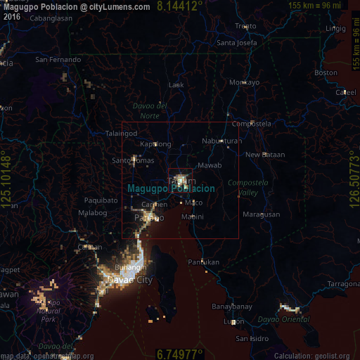
Analysis of Magugpo Poblacion night lights 2016
Square area 10x10 km:
 1.3%
1.3%90-99
3.03%80-89
4.11%70-79
3.68%60-69
1.95%50-59
5.63%40-49
3.03%30-39
3.68%20-29
4.76%10-19
9.74%0-9
59.09%Square area 50x50 km:
0.16%90-99
0.28%80-89
0.53%70-79
0.44%60-69
0.36%50-59
0.67%40-49
0.7%30-39
0.88%20-29
0.58%10-19
2.51%0-9
92.9%Clear (daylight) street map image can be seen on geolist.org.
Map coordinates:
8° 8' 38.8" North, 125° 6' 5.3" East
7° 26' 51" North, 125° 48' 16.6" East
6° 44' 59.2" North, 126° 30' 27.8" East
Some cities around Magugpo Poblacion sort by population:
• New Corella
15.6 km =9.7 mi,  7°
7°
• Cabayangan
9.1 km =5.7 mi,  240°
240°
• Maco
11 km =6.8 mi,  149°
149°
• Cambanugoy
11.8 km =7.3 mi,  332°
332°
• Carmen
14.5 km =9 mi,  228°
228°
• Corocotan
6.4 km =4 mi,  213°
213°
• Cuambog
16.2 km =10.1 mi,  162°
162°
• Magatos
14.8 km =9.2 mi,  324°
324°
1684269 (p: 233,254)
Sources (retrieved 2019-11-25):
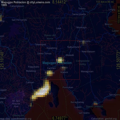
» NASA, Earths city lights 1995
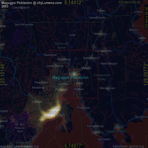
» NASA city lights 2003
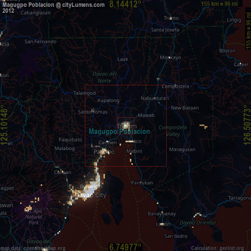
» Earth at Night: Flat Maps 2012, 2016