Lupao night lights from space
Night Light of Lupao (Central Luzon) from space (Philippines) Src. Average luminocity for 10x10km area is 0.684% and for 50x50km: 0.8035%.
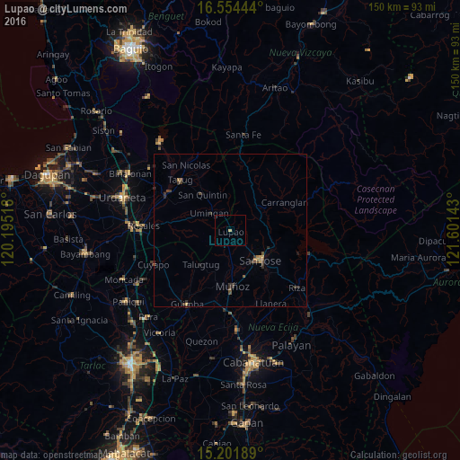
Analysis of Lupao night lights 2016
Square area 10x10 km:
 0%
0%90-99
0%80-89
0%70-79
0.87%60-69
0%50-59
0%40-49
0%30-39
0%20-29
0%10-19
0%0-9
99.13%Square area 50x50 km:
0%90-99
0%80-89
0.04%70-79
0.16%60-69
0.15%50-59
0.11%40-49
0.26%30-39
0.48%20-29
0.2%10-19
0.24%0-9
98.37%Clear (daylight) street map image can be seen on geolist.org.
Map coordinates:
16° 33' 16" North, 120° 11' 42.6" East
15° 52' 45.5" North, 120° 53' 53.9" East
15° 12' 6.8" North, 121° 36' 5.1" East
Some cities around Lupao sort by population:
• Muñoz
18.2 km =11.3 mi,  178°
178°
• Tayug
23.4 km =14.5 mi,  314°
314°
• Carranglan
19.9 km =12.4 mi,  62°
62°
• Baloc
26.3 km =16.3 mi, 183°
• Talugtug
14.6 km =9.1 mi,  219°
219°
• Santo Rosario
26.4 km =16.4 mi,  188°
188°
• Natividad
21.2 km =13.2 mi,  329°
329°
• Santo Tomas
16 km =9.9 mi,  154°
154°
1704994 (p: 11,000)
Sources (retrieved 2019-11-25):
» Earth at Night: Flat Maps 2012, 2016