Liboro night lights from space
Night Light of Liboro (Bicol) from space (Philippines) Src. Average luminocity for 10x10km area is 0% and for 50x50km: 0.0884%.
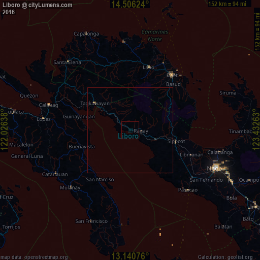
Analysis of Liboro night lights 2016
Square area 10x10 km:
 0%
0%90-99
0%80-89
0%70-79
0%60-69
0%50-59
0%40-49
0%30-39
0%20-29
0%10-19
0%0-9
100%Square area 50x50 km:
0%90-99
0%80-89
0%70-79
0.03%60-69
0%50-59
0.03%40-49
0.03%30-39
0.03%20-29
0.03%10-19
0%0-9
99.83%Clear (daylight) street map image can be seen on geolist.org.
Map coordinates:
14° 30' 22.5" North, 122° 1' 35" East
13° 49' 28.2" North, 122° 43' 46.2" East
13° 8' 26.7" North, 123° 25' 57.5" East
Some cities around Liboro sort by population:
• Sipocot
27.4 km =17 mi,  103°
103°
• San Narciso
33.5 km =20.8 mi,  211°
211°
• Ragay
6.8 km =4.2 mi, 95°
• Tagkawayan Sabang
28.4 km =17.6 mi,  310°
310°
• Cambuga
38 km =23.6 mi,  232°
232°
• Mambulo
36.6 km =22.7 mi,  109°
109°
• Tulay na Lupa
30.5 km =19 mi,  11°
11°
• Basud
36.8 km =22.9 mi,  43°
43°
1706598 (p: 6,028)
Sources (retrieved 2019-11-25):
» Earth at Night: Flat Maps 2012, 2016