Laur night lights from space
Night Light of Laur (Central Luzon) from space (Philippines) Src. Average luminocity for 10x10km area is 0.3723% and for 50x50km: 1.7335%.
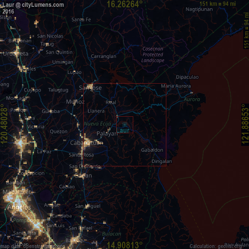
Analysis of Laur night lights 2016
Square area 10x10 km:
 0%
0%90-99
0%80-89
0%70-79
0%60-69
0%50-59
0%40-49
0%30-39
0.87%20-29
0%10-19
0%0-9
99.13%Square area 50x50 km:
0%90-99
0.03%80-89
0.15%70-79
0.55%60-69
0.37%50-59
0.17%40-49
0.43%30-39
0.47%20-29
0.26%10-19
1.13%0-9
96.45%Clear (daylight) street map image can be seen on geolist.org.
Map coordinates:
16° 15' 45.5" North, 120° 28' 49" East
15° 35' 11.4" North, 121° 11' 0.2" East
14° 54' 29.3" North, 121° 53' 11.5" East
Some cities around Laur sort by population:
• Bongabon
6.5 km =4 mi,  320°
320°
• Rizal
16.2 km =10.1 mi,  329°
329°
• Palayan City
11.7 km =7.3 mi,  244°
244°
• General Mamerto Natividad
14.2 km =8.8 mi,  277°
277°
• Mabini
21.5 km =13.4 mi,  274°
274°
• Gabaldon
22.4 km =13.9 mi,  131°
131°
• Ligaya
14.1 km =8.8 mi, 127°
• Llanera
19.7 km =12.2 mi,  295°
295°
1707049 (p: 19,206)
Sources (retrieved 2019-11-25):
» Earth at Night: Flat Maps 2012, 2016