Lalig night lights from space
Night Light of Lalig (Calabarzon) from space (Philippines) Src. Average luminocity for 10x10km area is 10.9719% and for 50x50km: 12.8249%.
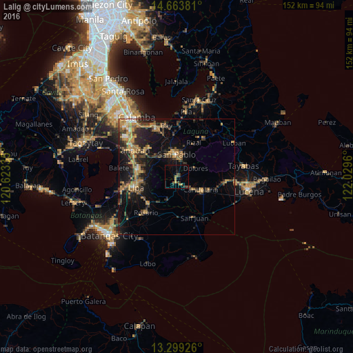
Analysis of Lalig night lights 2016
Square area 10x10 km:
 0%
0%90-99
0%80-89
0.43%70-79
3.9%60-69
0.22%50-59
3.25%40-49
2.16%30-39
3.68%20-29
0.65%10-19
0.87%0-9
84.85%Square area 50x50 km:
0.43%90-99
0.58%80-89
0.89%70-79
3.91%60-69
2.65%50-59
1.37%40-49
2.73%30-39
3.05%20-29
3.6%10-19
9.33%0-9
71.47%Clear (daylight) street map image can be seen on geolist.org.
Map coordinates:
14° 39' 49.7" North, 120° 37' 24.1" East
13° 58' 57.2" North, 121° 19' 35.3" East
13° 17' 57.3" North, 122° 1' 46.6" East
Some cities around Lalig sort by population:
• San Pablo
9.5 km =5.9 mi,  359°
359°
• Candelaria
11.9 km =7.4 mi,  118°
118°
• Alaminos
12.5 km =7.8 mi,  316°
316°
• Malabanban Norte
12 km =7.5 mi,  110°
110°
• Lusacan
3.6 km =2.2 mi,  146°
146°
• Masalukot Uno
10.4 km =6.5 mi, 106°
• Dolores
10.1 km =6.3 mi,  63°
63°
• Tiaong
2.2 km =1.4 mi,  195°
195°
1707887 (p: 14,729)
Sources (retrieved 2019-11-25):
» Earth at Night: Flat Maps 2012, 2016