Lusacan night lights from space
Night Light of Lusacan (Calabarzon) from space (Philippines) Src. Average luminocity for 10x10km area is 10.843% and for 50x50km: 10.9213%.
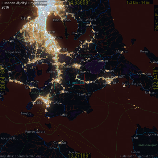
Analysis of Lusacan night lights 2016
Square area 10x10 km:
 0%
0%90-99
0%80-89
0.41%70-79
3.93%60-69
0.41%50-59
3.31%40-49
3.1%30-39
3.72%20-29
1.24%10-19
0.41%0-9
83.47%Square area 50x50 km:
0.31%90-99
0.37%80-89
0.79%70-79
3.39%60-69
2.25%50-59
1.17%40-49
2.24%30-39
2.63%20-29
3.02%10-19
8.23%0-9
75.61%Clear (daylight) street map image can be seen on geolist.org.
Map coordinates:
14° 38' 11.7" North, 120° 38' 29.9" East
13° 57' 18.8" North, 121° 20' 41.2" East
13° 16' 18.7" North, 122° 2' 52.4" East
Some cities around Lusacan sort by population:
• San Pablo
12.7 km =7.9 mi,  350°
350°
• Candelaria
8.9 km =5.5 mi,  107°
107°
• Malabanban Norte
9.3 km =5.8 mi,  96°
96°
• Lalig
3.6 km =2.2 mi,  326°
326°
• Masalukot Uno
8 km =5 mi,  89°
89°
• Dolores
10.3 km =6.4 mi,  43°
43°
• Santa Catalina Norte
9.5 km =5.9 mi,  171°
171°
• Tiaong
2.7 km =1.7 mi,  290°
290°
1704959 (p: 14,870)
Sources (retrieved 2019-11-25):
» Earth at Night: Flat Maps 2012, 2016