Digos night lights from space
Night Light of Digos (Davao) from space (Philippines) Src. Average luminocity for 10x10km area is 18.3766% and for 50x50km: 1.9506%.
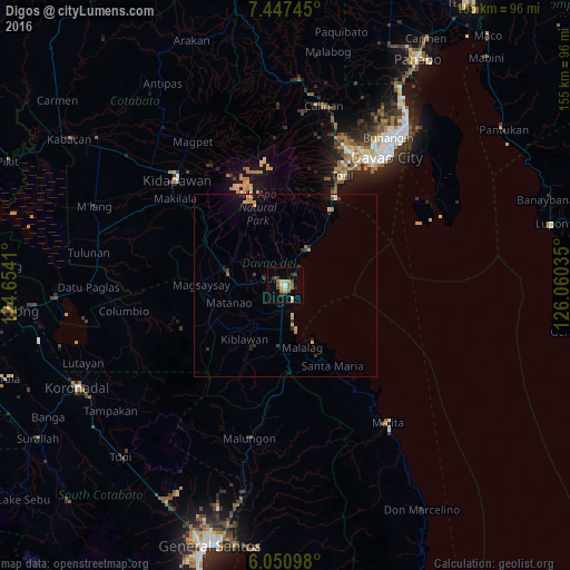
Analysis of Digos night lights 2016
Square area 10x10 km:
 0.87%
0.87%90-99
2.38%80-89
0.65%70-79
4.76%60-69
3.46%50-59
3.46%40-49
3.03%30-39
4.11%20-29
1.08%10-19
3.9%0-9
72.29%Square area 50x50 km:
0.08%90-99
0.12%80-89
0.22%70-79
0.59%60-69
0.24%50-59
0.17%40-49
0.19%30-39
0.51%20-29
0.29%10-19
0.71%0-9
96.88%Clear (daylight) street map image can be seen on geolist.org.
Map coordinates:
7° 26' 50.8" North, 124° 39' 14.8" East
6° 44' 59" North, 125° 21' 26" East
6° 3' 3.5" North, 126° 3' 37.3" East
Some cities around Digos sort by population:
• Bansalan
16.4 km =10.2 mi,  284°
284°
• Guihing Proper
7.3 km =4.5 mi,  184°
184°
• Padada
12.2 km =7.6 mi,  186°
186°
• Hagonoy
8.2 km =5.1 mi,  205°
205°
• Matanao
13.7 km =8.5 mi,  235°
235°
• Coronon
17.6 km =10.9 mi,  35°
35°
• Sulop
16.9 km =10.5 mi, 185°
• Tuban
8.8 km =5.5 mi,  21°
21°
1714956 (p: 116,122)
Sources (retrieved 2019-11-25):
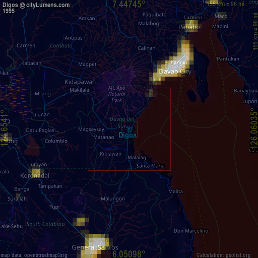
» NASA, Earths city lights 1995
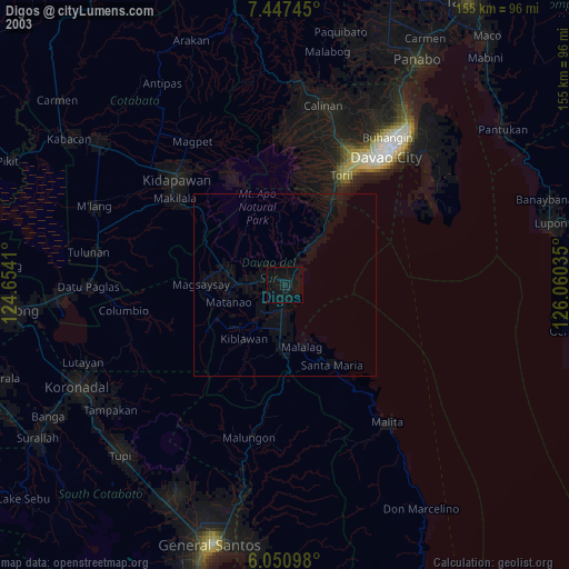
» NASA city lights 2003
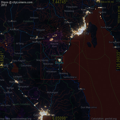
» Earth at Night: Flat Maps 2012, 2016